Swaziland, one of the smallest countries in Africa, is almost enclosed within South Africa, sharing just the northern half of its eastern border with Mozambique. Its population of 1.13 million (2006) is distributed over an area of 17,370 km2.
Between 75% and 83% of the annual rainfall comes from October to March. Precipitation ranges from 500 mm in the south-east to 1,500 mm in the west, the average being 1,200 mm. Read more
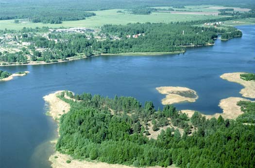
The Vuoksi is a transboundary river that flows 150 km from Lake Saimaa in south-eastern Finland to Lake Ladoga in north-western Russia. The Vuoksi River basin extends between these two lakes and covers an area of 4,100 km2. It is part of the much larger basin through which the Neva River flows to the Baltic Sea. Read more
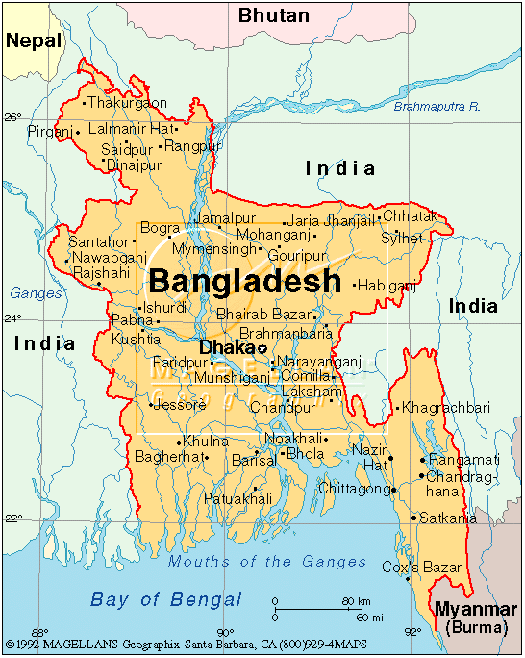
Bangladesh is situated in the deltaic plain formed by three large rivers – the Ganges, the Brahmaputra and the Meghna. The combined total catchment of about 1.7 million km2 extends over Bhutan, China, India and Nepal. Only about 7% of this huge catchment lies in Bangladesh.
Most of Bangladesh is low-lying and relatively flat. A network of about 230 rivers, of which 57 are transboundary, forms a web of interconnecting channels throughout the country. Read more
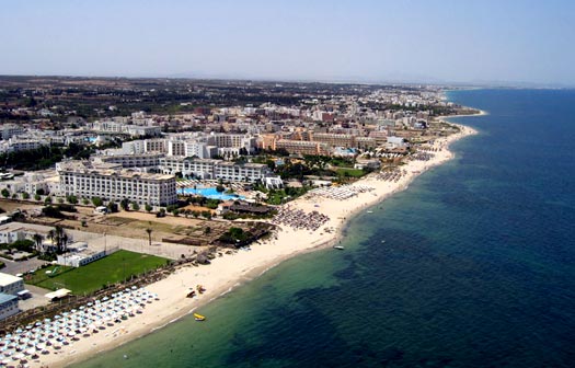
The predominant climate types are Mediterranean in the north and Saharan in the south. Four climatic sub-regions can be identified: sub-humid in the far north, semi-arid in the northwest and at Cap Bon, arid in the centre and hyper-arid and desert in most of the south. Over 40% of the country lies in the hyper-arid zone. Although average annual rainfall amounts to 220 mm, geographic variation is substantial, with regional averages ranging from 1,500 mm in the north to 50 mm in the far south, in the heart of the Sahara.
The arid plains that mark the northern limit of the Sahara include many depressions, locally called chotts and sebkhats, which fill with water in winter and dry up in summer. Their water is highly saline. The largest chott, Jerid, is a 500 km2 salt lake. Read more
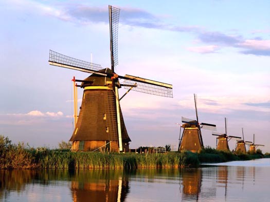
The Netherlands is located in Western Europe, bordered by Belgium to the south, Germany to the east and the North Sea to the north and west. Geographically, the Netherlands is a flat, low-lying country formed by the estuary of four important European rivers: the Rhine, the Meuse, the Ems and the Scheldt.
Two-thirds of the country is threatened by flooding. Through history, the country has defended itself against threats posed by water, building dikes and dams, canalizing rivers and reclaiming land from the sea. Today, about 9.6 million of its inhabitants (60% of the population) live below sea level, and about 70% of the country’s GDP is generated below sea level thanks to a 3,500 km primary flood defence system composed of dikes and sand dunes. Read more