


Surface water seasonality between October 2014 and October 2015 in the Sundarbans in Bangladesh. Dark blue indicates
Where and when surface water occurs on Earth is vitally important for all life. But that water is constantly in flux. Lakes, rivers and wetlands naturally ebb and flow; humans divert water for their own use and dam it up into reservoirs. Now researchers have mapped millions of high-resolution satellite images to document Earth’s surface water history going back three decades—revealing humanity’s dramatic influence as well as the natural variability of water patterns.
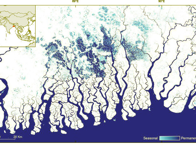
Agricultural engineer Jean-Francois Pekel and colleagues have created a kind of virtual time machine, showing past changes in surface water and providing a baseline for charting the changing future of our watery world. To achieve this feat, Pekel and colleagues used more than 3 million LANDSAT images of Earth’s lakes, wetlands, and rivers taken between 1984 and 2015. They quantified global water system changes over that timeline on a month-to-month basis. Then, they analyzed this veritable ocean of satellite data with the Google Earth Engine cloud-computing platform. Read more


