

Water Resources Management in Afghanistan: The Issues and Options
Physiography
Afghanistan is located between 29o 35’ – 38o 40’ latitude and 60o 31’ – 74o 55’ of longitude. It is bounded by Turkmenistan, Uzbekistan and Tajikistan in the North, China to the Northeast, Pakistan to the East and South and Iran to the West (Figure). Afghanistan is characterized by its rugged mountains with snow-covered peaks of high altitude, up to 7500 meters above sea level (m asl), fertile valleys and desert plains. Lowlands include river valleys and desert regions are located in the northern, western, southwestern and southeastern parts while high lands are generally located in the central part of the country. From topographical point of view the country can be divided into three groups. Low lands with 300-500 m asl; medium land with 500-2000 m asl and high land between 2000-7500 m asl. About half of the country has an altitude of more than 2000 m asl.
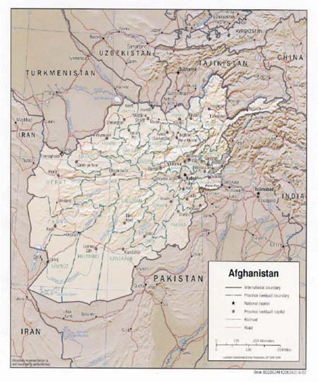
Map of Afghanistan showing its location in the region
The total land area of Afghanistan is about 65 million ha of which approximately 80 percent is either mountainous or desert. The forest cover is only 1.3 million ha or about 2 percent of the total land area. In recent years forest cover has reduced due to continuous demands for fuel wood and illegal logging. The demand for fuel wood by communities is considered less damaging than illegal logging. It is estimated that forest cut rates are exceeding annual growth rates leaving a deficit of about 30,000 ha of forest per year.
Administratively, Afghanistan is divided into 30 provinces (two provinces have very recently been added). The current population of Afghanistan is estimated at about 20 million with a rural population of around 16.5 million. They live in approximately 20,000 villages scattered across Afghanistan. The scatter of villages is mainly based on the existence of water. Majority of the rural population is small subsistence farmers who live of small plots of land.
Although there are marked geographical differences in wealth generating capacities across the country, there is a similar cross-section to village society irrespective of location or agro-ecological zone. This cross-section covers small landholders, landowners, sharecroppers, female-headed households and landless. The average holding was 3 ha in 1967. The vast majority of holding fall in the range of 0.5 to 6 ha. Holding under 20 ha accounted for 60% of land ownership in 1967 and those over 100 ha for 8%. Distribution of farm size in irrigated and rained areas is given in Table.
Farm size distribution in Afghanistan
| Farm size (ha) | Irrigated farms (%) | Rainfed farms (%) |
| < 3 | 83 | 8 |
| 3-6 | 14 | 8 |
| > 6 | 3 | 84 |
| Median | 1,4 ha | 6-7 ha |
Source: Water Resources Management in Afghanistan: The Issues and Options by Asad Sarwar Qureshi, IWMI, Working Paper 49
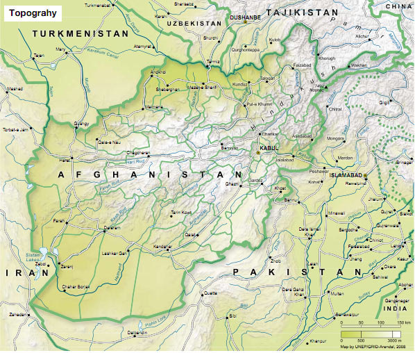
Topographic map
Source: Afghanistan’s environment 2008. Executive summary, UNEP