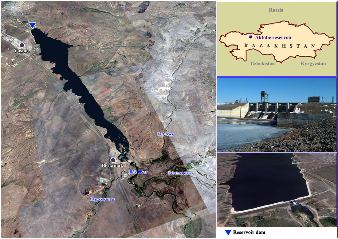
Aktobe reservoir
RESERVOIR
Location: Aktobe region
Water source: Ilek river
Reservoir type: In-stream
Purpose of operation: Water supply, Irrigation
Year of putting into operation: 1988
Normal maximum operating level (m):
Total capacity (mln. m3): 245
Active capacity (mln. m3): 220
Dead storage capacity (mln. m3): 25
Water surface (km2): 32.5
Length (km): 35
Width (km): 3
Maximum depth (m): 18.5
DAM
Dam type: Earth
Height (m): 22.7
Length (m): 1,085
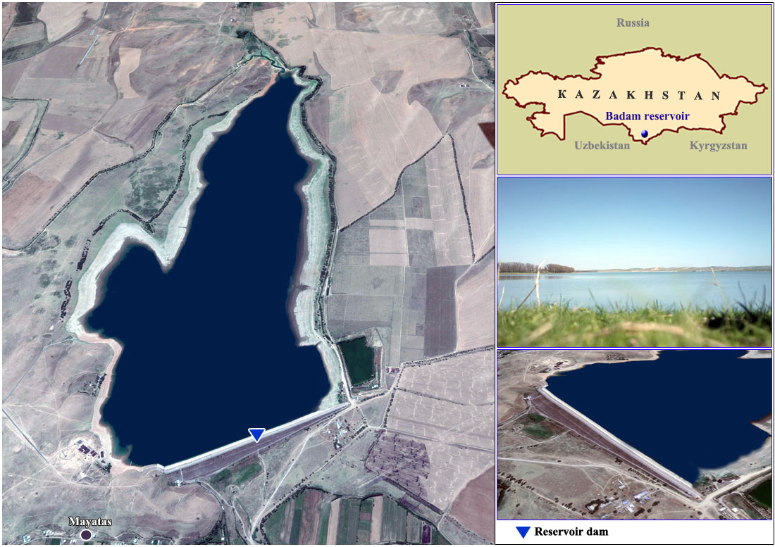
Badam reservoir
RESERVOIR
Location: Turkestan (ex South Kazakhstan) province
Water source: Badam river
Reservoir type: Off-stream
Purpose of operation: Irrigation
Year of putting into operation: 1974
Normal maximum operating level (m): 649.4
Total capacity (mln. m3): 61.5
Active capacity (mln. m3): 59.0
Dead storage capacity (mln. m3): 2.5
Water surface (km2): 4.75
Length (km): 4.0
Width (km): 1.5
Maximum depth (m): 42.6
DAM
Dam type: Earth
Height (m): 43
Length (m): 1,152
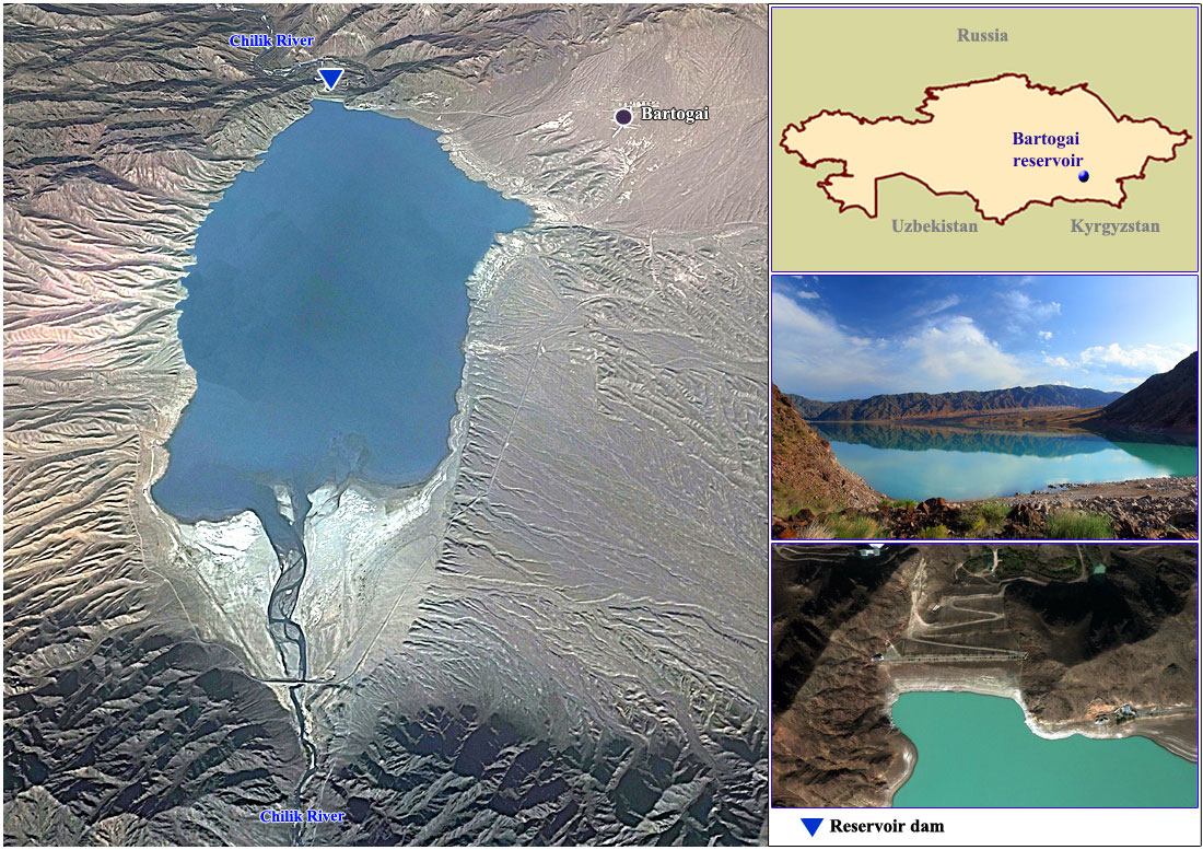
Bartogai reservoir
Location: Almaty region
Water source: Shelek river
Reservoir type: In-stream
Purpose of operation: Irrigation
Year of putting into operation: 1994
Normal maximum operating level (m): 1067,2
Total capacity (mln. m3): 320
Active capacity (mln. m3): 250
Dead storage capacity (mln. m3): 70
Water surface (km2): 13
Length (km): 6
Width (km): 3
Maximum depth (m):
DAM
Dam type: Rock-fill dam
Height (m): 60,0
Length (m): 325
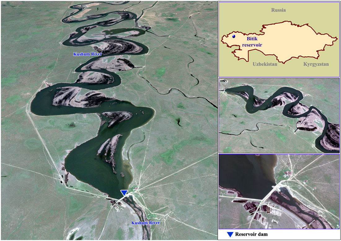
Bitik reservoir
RESERVOIR
Location: West Kazakhstan province
Water source: Kushum river
Reservoir type: In-stream
Purpose of operation: Irrigation
Year of putting into operation: 1970
Normal maximum operating level (m): 15,5
Total capacity (mln. m3): 106,72
Active capacity (mln. m3): 100
Dead storage capacity (mln. m3): 6,72
Water surface (km2): 53,0
Length (km): 15,3
Width (km): 2
Maximum depth (m): 10
DAM
Dam type: -
Height (m): -
Length (m): -
 <
<
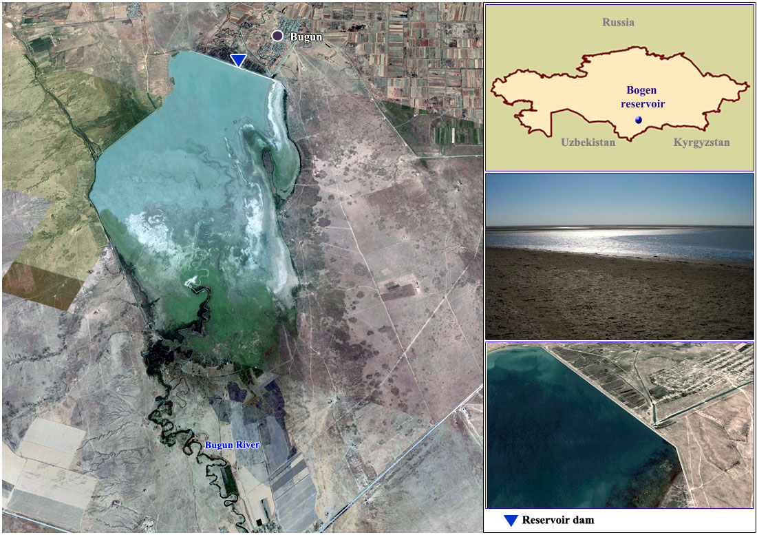
Bogen reservoir
Location: Turkestan (ex South Kazakhstan) province
Water source: Bogen river
Reservoir type: Off-stream
Purpose of operation: Irrigation
Year of putting into operation: 1967
Normal maximum operating level (m): 259,8
Total capacity (mln. m3): 370
Active capacity (mln. m3): 365
Dead storage capacity (mln. m3): 5
Water surface (km2): 63,5
Length (km): 13
Width (km): 6
Maximum depth (m): 15
DAM
Dam type: Loamy
Height (m): 21,5
Length (m): 5300
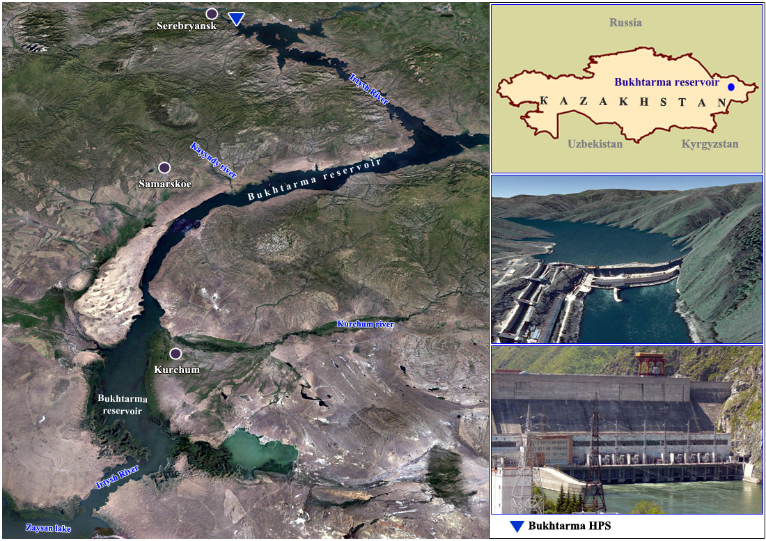
Bukhtarma reservoir and HEPS
RESERVOIR
Location: East Kazakhstan Region
Water source: Irtysh river
Reservoir type: Stream
Purpose of operation: Hydropower, transport
Year of putting into operation: 1960
Normal maximum operating level (m): 482
Total capacity (mln. m3): 49,620
Active capacity (mln. m3): 30,810
Dead storage capacity (mln. m3): 18,810
Water surface (km2): 5,490
Length (km): 425
Width (km): 35
Maximum depth (m): 59.6
DAM
Dam type: Concrete gravity dam
Height (m): 90
Length (m): 380
HEPS
Design capacity (MW): 675
Mean annual energy generation (MkWh): 2,770
Design head (m): 68
Number of generating units: 8
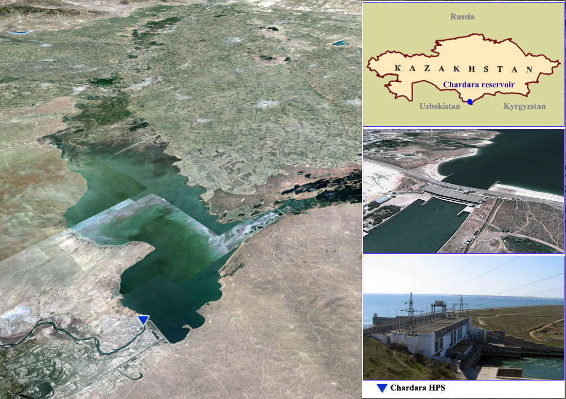
Chardara (Shardara) reservoir and HEPS
RESERVOIR
Location: Turkestan (ex South Kazakhstan) province
Water source: Syrdarya river
Reservoir type: In-stream
Purpose of operation: Irrigation, Hydropower
Year of putting into operation: 1967
Normal maximum operating level (m): 252.0
Total capacity (mln. m3): 5,700
Active capacity (mln. m3): 4,200
Dead storage capacity (mln. m3): 1,500
Water surface (km2): 783.4
Length (km): 80.0
Width (km): 25.0
Maximum depth (m): 26
DAM
Dam type: Earth
Height (m): 27
Length (m): 5,400
HEPS
Design capacity (MW): 100
Mean annual energy generation (MkWh): 377
Design head (m): 15.8
Number of generating units: 4
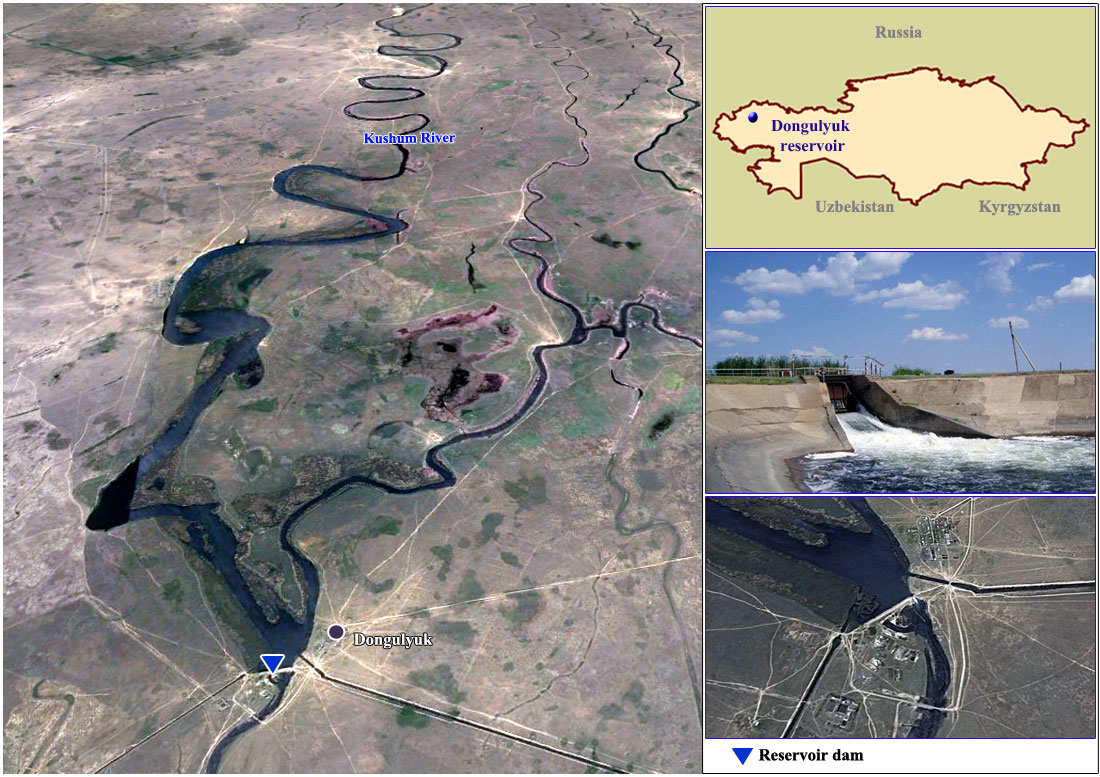
Dongulyuk reservoir
RESERVOIR
Location: West Kazakhstan province
Water source: Kushum river
Reservoir type: In-stream
Purpose of operation: Water supply
Year of putting into operation: 1967
Normal maximum operating level (m): 10,5
Total capacity (mln. m3): 57,4
Active capacity (mln. m3): 51,5
Dead storage capacity (mln. m3): 6,0
Water surface (km2): 31,4
Length (km): 16
Width (km): 1,45
Maximum depth (m): 8,5
DAM
Dam type: -
Height (m): -
Length (m): -
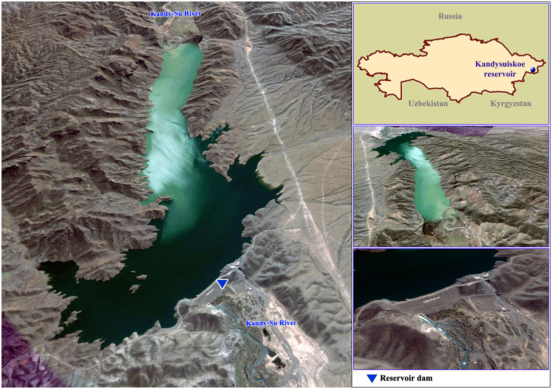
Kandysui reservoir
RESERVOIR
Location: East Kazakhstan province
Water source: Randy-Su river
Reservoir type: Off-stream
Purpose of operation: Irrigation
Year of putting into operation: 1983
Normal maximum operating level (m): 962,5
Total capacity (mln. m3): 43,7
Active capacity (mln. m3): 42
Dead storage capacity (mln. m3): 1,7
Water surface (km2): 3,15
Length (km): 4,3
Width (km): 1,01
Maximum depth (m):
DAM
Dam type: -
Height (m): -
Length (m): -
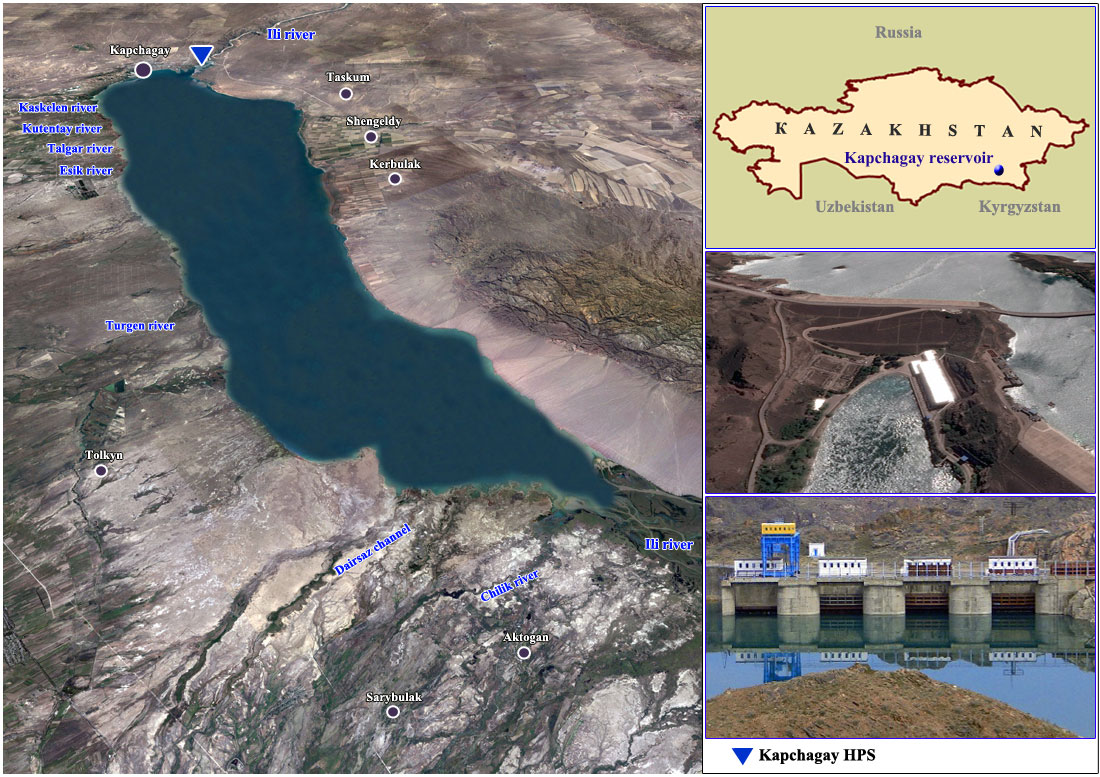
Kapchagay reservoir and HEPS
RESERVOIR
Location: Almaty region
Water source: Ili river
Reservoir type: In-stream
Purpose of operation: Hydropower, Irrigation
Year of putting into operation: 1970
Normal maximum operating level (m): 485.0
Total capacity (mln. m3): 28,140
Active capacity (mln. m3): 6,640
Dead storage capacity (mln. m3): 21,500
Water surface (km2): 1847
Length (km): 118.0
Width (km): 12.0
Maximum depth (m): 40.0
DAM
Dam type: Sand
Height (m): 50
Length (m): 470
HEPS
Design capacity (MW): 364
Mean annual energy generation (MkWh): 972
Design head (m): 40.9
Number of generating units: 4
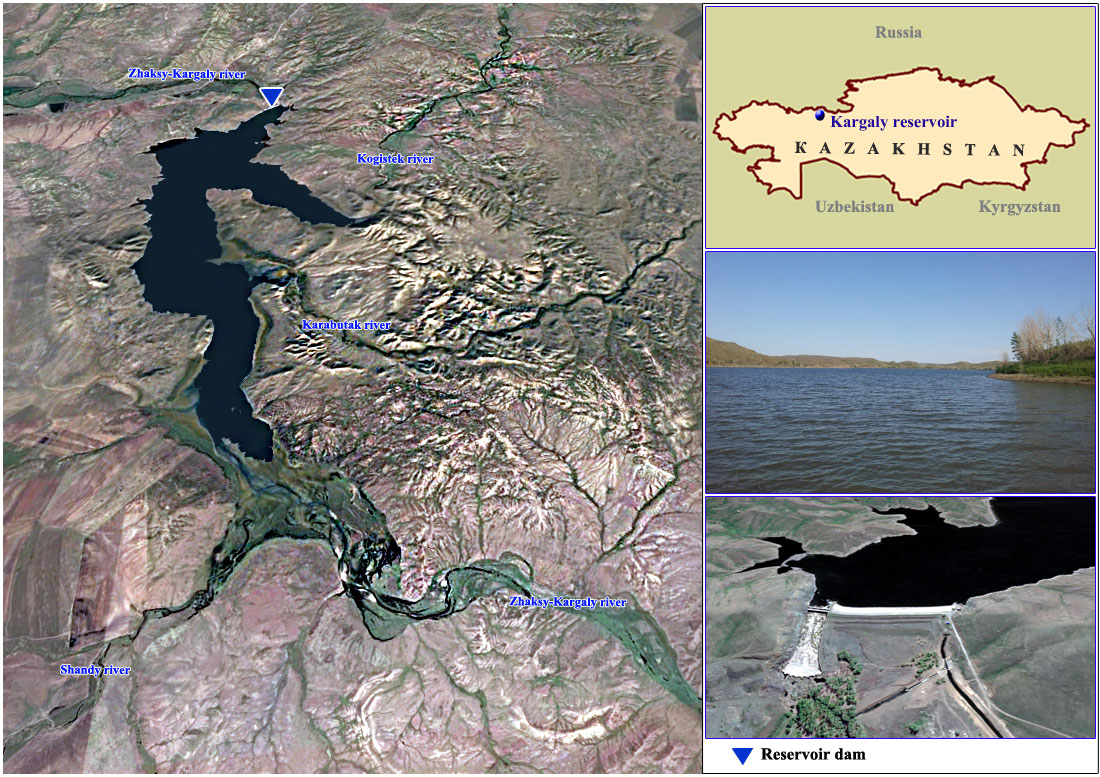
Kargaly reservoir
RESERVOIR
Location: Aktobe region
Water source: Kargaly river
Reservoir type: In-stream
Purpose of operation: Irrigation
Year of putting into operation: 1975
Normal maximum operating level (m):
Total capacity (mln. m3): 208.0
Active capacity (mln. m3): 262.0
Dead storage capacity (mln. m3): 18.0
Water surface (km2): 28.5
Length (km): 13.7
Width (km): 3.0
Maximum depth (m): 31.8
DAM
Dam type: Earth
Height (m): 35
Length (m): 325
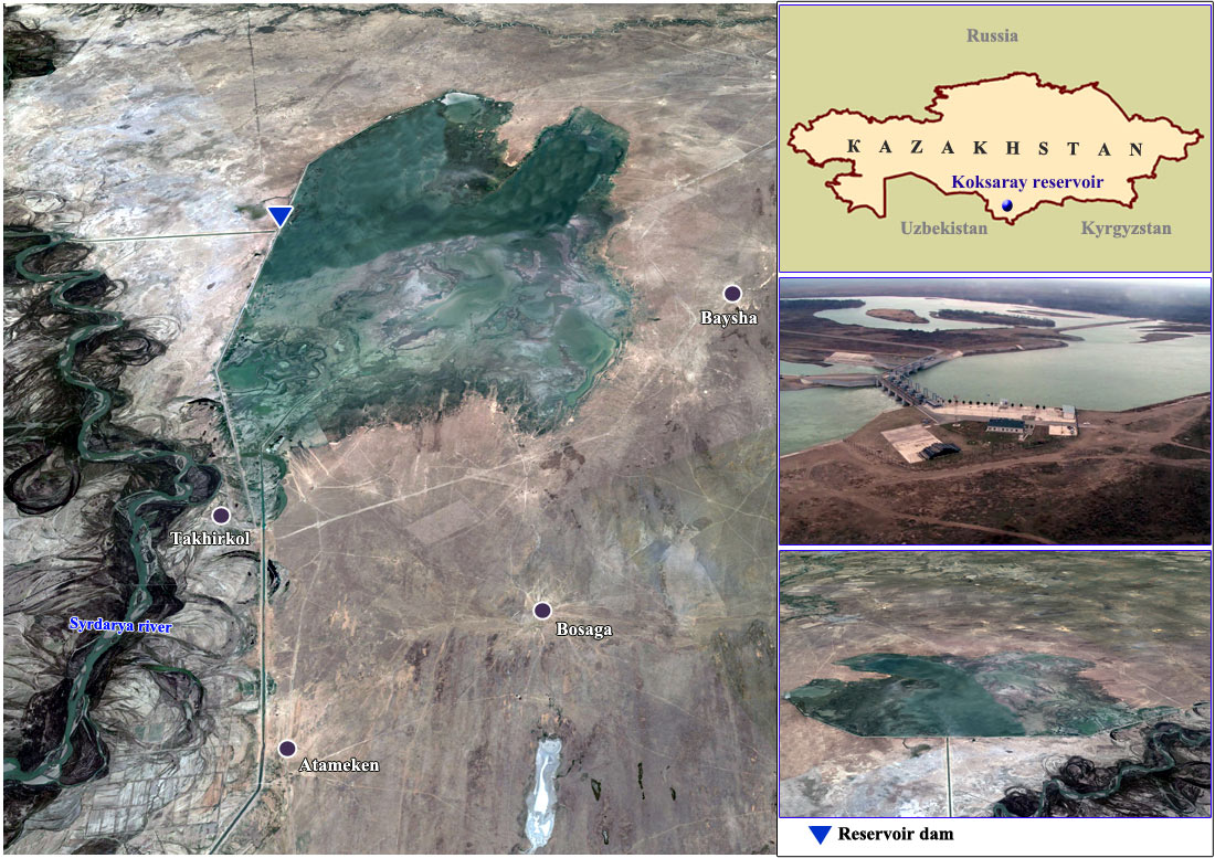
Koksaray reservoir
RESERVOIR
Location: Turkestan (ex South Kazakhstan) province
Water source: Syrdarya river
Reservoir type: Off-stream
Purpose of operation: Counter regulator, Irrigation
Year of putting into operation: 2008
Normal maximum operating level (m): 7.7
Total capacity (mln. m3): 4,160
Active capacity (mln. m3): 3,000
Dead storage capacity (mln. m3): 1,160
Water surface (km2): 467.5
Length (km): 44,7
Width (km): 10,2
Maximum depth (m): 7
DAM
Dam type: Concrete
Height (m): 7.7
Length (m): 44,700
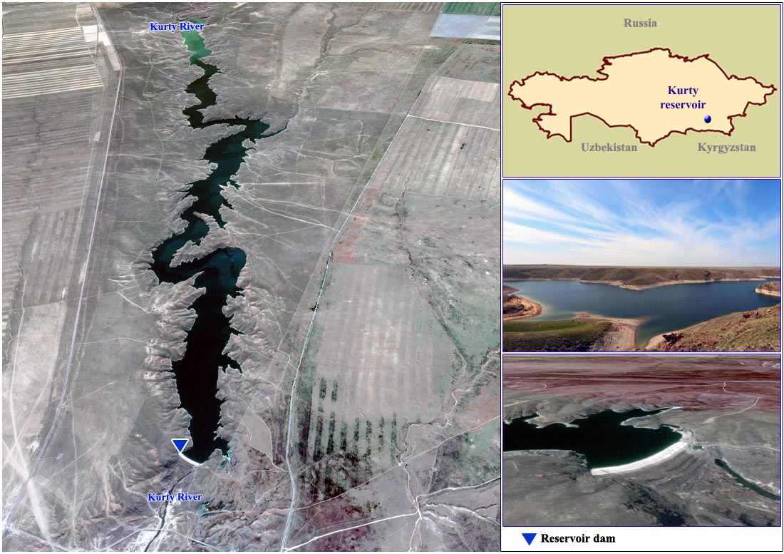
Kurty reservoir
RESERVOIR
Location: Almaty region
Water source: Kurty river
Reservoir type: In-stream
Purpose of operation: Irrigation
Year of putting into operation: 1967
Normal maximum operating level (m): 558,4
Total capacity mln. m3: 120
Active capacity mln. m3: 114,8
Dead storage capacity mln. m3: 5,2
Water surface (km2): 8,3
Length (km): 25
Width (km): 0,3
Maximum depth (m): 38,5 DAM
Dam type:
Height (m): -
Length (m): -
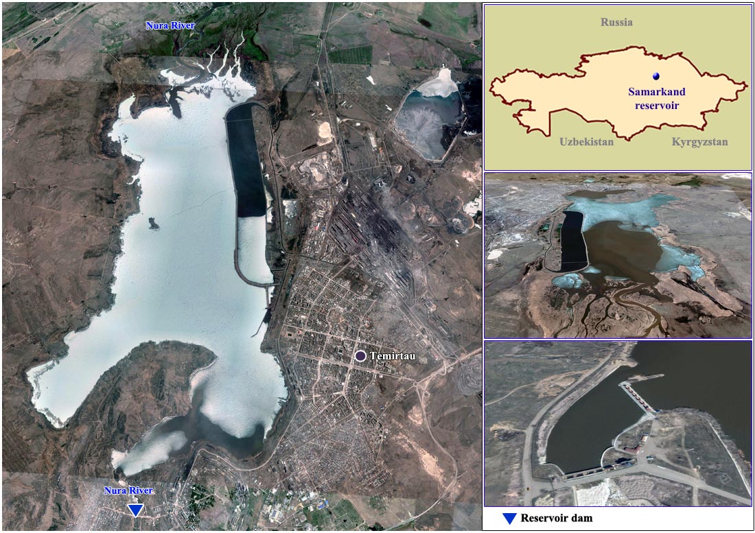
Samarkand reservoir
RESERVOIR
Location: Kharaganda province
Water source: Nura river
Reservoir type: In-stream
Purpose of operation: Water supply, Irrigation
Year of putting into operation: 1941
Normal maximum operating level (m): 490,17
Total capacity mln. m3: 260,8
Active capacity mln. m3: 110
Dead storage capacity mln. m3: 150,8
Water surface (km2): 82
Length (km): 25
Width (km): 7
Maximum depth (m): 12
DAM
Dam type:
Height (m): -
Length (m): -
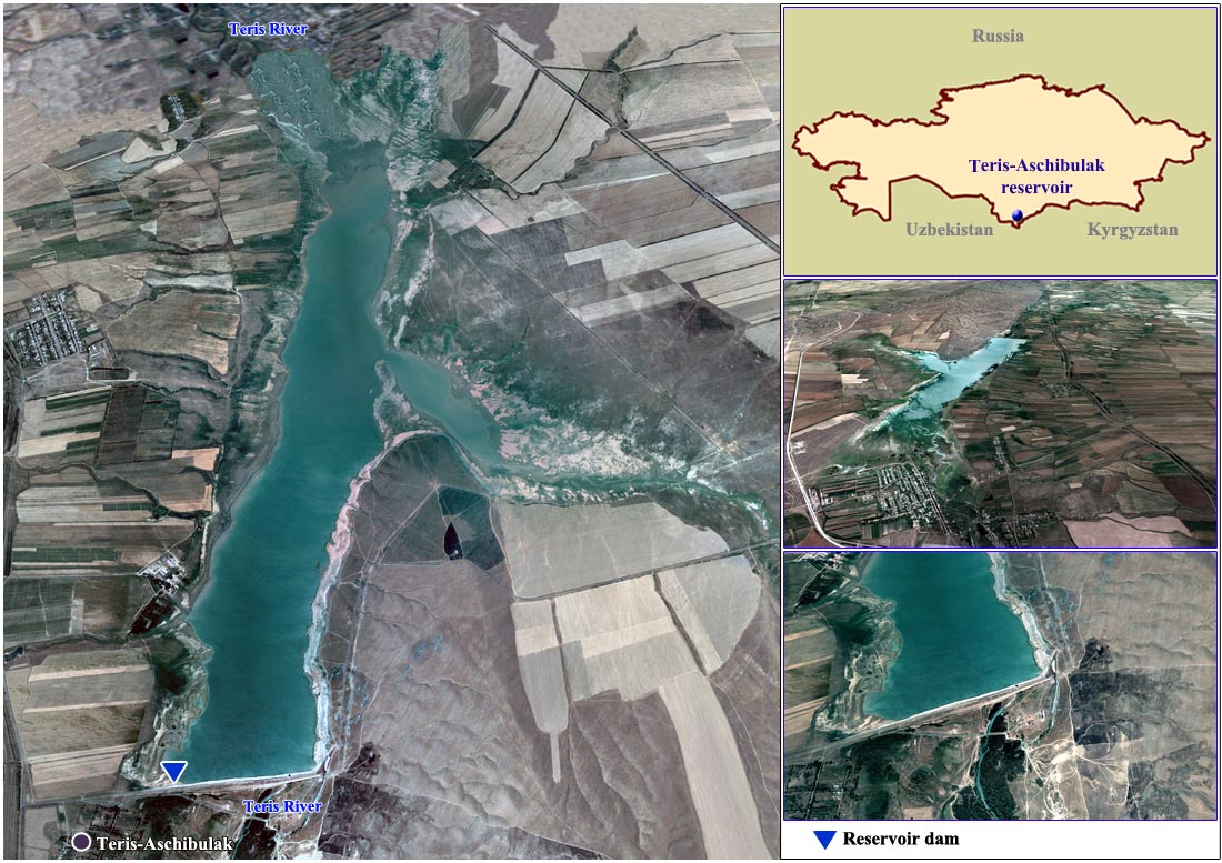
Teris-Aschibulak reservoir
RESERVOIR
Location: Jambyl Region
Water source: Teris river
Reservoir type: In-stream
Purpose of operation: Irrigation
Year of putting into operation: 1963
Normal maximum operating level (m): 648,6
Total capacity mln. m3: 158
Active capacity mln. m3: 156
Dead storage capacity mln. m3: 2
Water surface (km2): 24
Length (km): 9
Width (km): 1,5
Maximum depth (m):
DAM
Dam type: Earth
Height (m): 30
Length (m): 1960
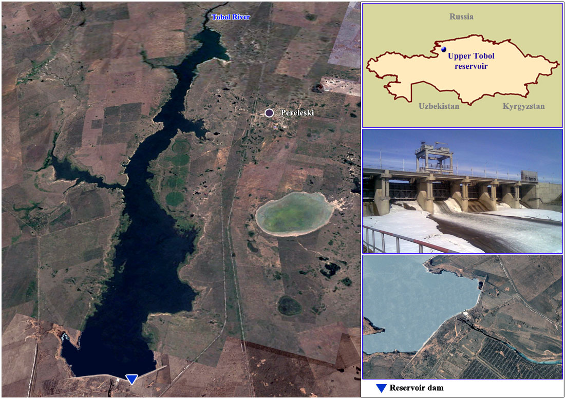
Upper Tobol reservoir
RESERVOIR
Location: Kostanay province
Water source: Tobol river
Reservoir type: In-stream
Purpose of operation: Water supply
Year of putting into operation: 1977
Normal maximum operating level (m): 206
Total capacity (mln. m3): 816,6
Active capacity (mln. m3): 780,9
Dead storage capacity (mln. m3): 35,7
Water surface (km2): 87,4
Length (km): 40
Width (km): 7,5
Maximum depth (m): 30
DAM
Dam type: Earth
Height (m): 42
Length (m): 4360
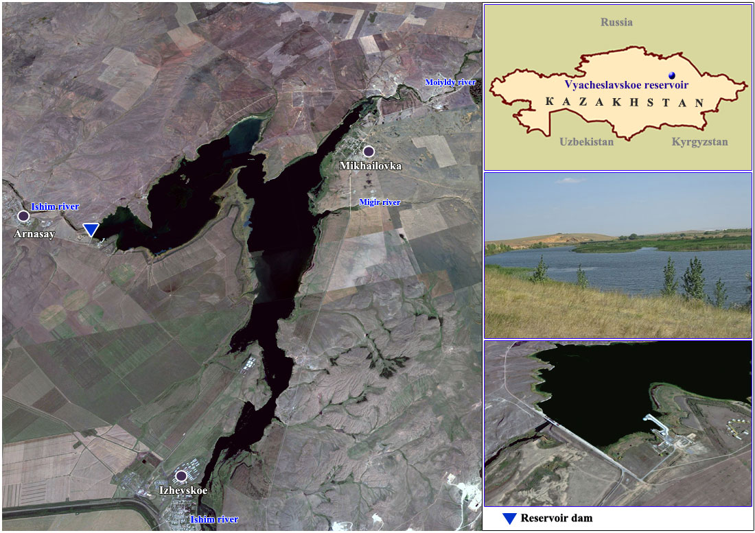
Vyacheslavskoe reservoir
RESERVOIR
Location: Akmola region
Water source: Ishim river
Reservoir type: In-stream
Purpose of operation: Water supply, Irrigation
Year of putting into operation: 1969
Normal maximum operating level (m):
Total capacity (mln. m3): 410.9
Active capacity (mln. m3): 375.4
Dead storage capacity (mln. m3): 35.5
Water surface (km2): 60.7
Length (km): 11.0
Width (km): 5.4
Maximum depth (m): 25.0
DAM
Dam type: Sand-gravel
Height (m):
Length (m): 1,016