Irrigation-based agricultural reclamation represents a system of organizational and economic as well as technical actions aimed at radical improvement of unfavorable natural (soil, climatic, and hydrological) conditions on the lands being reclaimed through directional change and regulation of water and associated air, nutritive, and thermal regimes with the view of progressive improvement of soil fertility and ensuring of high stable crop yield. Land irrigation would be effective only in combination with appropriate system of land treatment measures. The irrigation system includes the land, irrigation source, as well as irrigation, collector & drainage, and system of tail-water ditches or closed ducts, water intake, water distribution and water metering hydraulic structures, vertical drains (wells), roads, communication and power transmission lines. Subject to the way of water withdrawal from an irrigation source, irrigation systems are divided into gravity and pumping irrigation types.
Irrigation is one of hydraulic reclamation types in the areas of insufficient and unstable natural moistening which is oriented to prevent soil and partially atmospheric droughts through covering moisture deficit.
The main purpose of irrigation is to gain guaranteed crop irrespective of current weather conditions through regulation of water and associated air, thermal, salt, microbiological, and nutritive regimes in the soil. Irrigation is also applied for soil leaching, control of atmospheric drought, as an instrument against frost, for introducing mineral and organic fertilizers along with irrigation water as well as chemical weed and pest killers.
Irrigation method means an artificial technique of water conversion from the flowing over soil surface and through water passages into very new state of soil and air moisture content. Irrigation method is characterized by water contact with plants, soil, and air-ground interface and simultaneously running physical and physiological processes, duration and intensity of directed effect on plants and environment.
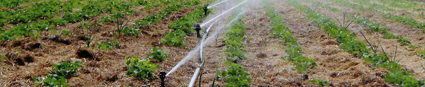
Classification of irrigation methods and technologies is based on a group of indicators that characterize comprehensively enough the key outstanding features of irrigation process and mechanism of its effect on plants and environment (soil – air-ground interface). The main of these features are: character and mechanism of water conversion from the water flow condition into the state of soil and air moisture content; degree of water and soil contact locality; duration and continuity of irrigation process; water supply intensity and degree of its conformity with the intensity of water consumption by plants. At present, three main irrigation methods are used: surface irrigation; sprinkling; and micro-irrigation (drip and subsoil irrigation).
Surface irrigation method: running over the soil surface, water moistens it due to gravity and capillary forces. In terms of the fitting of water supply intensity with the intensity of water consumption, surface irrigation is asynchronous, because water supply intensity is higher than the instantaneous and average daily intensity of water consumption.
There are several types of surface irrigation: by furrows; border dike irrigation; and check flooding. For each type of surface irrigation, there are different ways of its organization and technology. Irrigation technologies are under continuous improvement. The degree of perfection of water application technology and technique should be evaluated in the context of irrigation system and integrated cropping technology.
Water application means a one-time artificial moistening of soil and air-ground interface.
Water application technology implies a sequence of operations of water distribution process carried out according to a certain scheme, as well as used water application facilities and parameters of water application technique.
Irrigation technique implies the facilities, procedure of water application (by fixed or variable stream, discrete method) and parameters of water application technique components (furrow length, width of spaces between rows, discharges at furrow heads, water application time).
Water application equipment means facilities (machines, mechanisms, and implements) for irrigation.
Optimum water application technique components: such combination of water discharge to the furrow and water application time is used for a specific water application site that would ensure desired optimization conditions. Such conditions may consist in: highest efficiency of water application; highest estimated crop capacity; highest contingent net income; and other conditions that minimize consumption of irrigation water per unit of agricultural product. The problem of setting optimum values of irrigation technique components is solved by complementary methods: theoretical calculation (by using mathematical model of irrigation); field experiment, and trial water application.
(Seasonal) irrigation rate (depth) means the amount of water delivered per hectare of irrigated area during the growing season, which is measured in m3/ha or mm of water sheet. It is determined as the difference between total crop water consumption (evapotranspiration) and natural sufficiency of water supply for it. Generally, irrigation rate is taken equal to the total crop water consumption deficit during the growing season. Depending on its bioclimatic nature of intraseasonal distribution of irrigation rate, it is delivered to the field in parts in the form of water application rates calculated allowing for biological requirements of crops and conservation of soil.
Biological crop water consumption rate is equal to evapotranspiration of a normally growing crop under optimum soil conditions, including sufficient quantity of water and fertilizers and its growing under such conditions, reaching potential productivity.
Water application rate (depth) means the amount of water delivered to the field for a single water application, which is measured in m3/ha or mm of water sheet. In the general case, the value of water application rate depends on water and physical properties of soil, extent of its drying up by water application time, required depth of wetting, water application method and technique. With furrow irrigation, water application rate is set in view of reducing moisture in the design soil layer to lowest water capacity. Since at water application some part of water is lost to evaporation, this volume of water should be taken into account. The time and duration of irrigation interval are set in accordance with intraseasonal distribution of irrigation rate and size of water application rate.
Water application site is a part of the territory of irrigated fields where there is no a network of permanent canals, water application and mechanized treatment as well as all mechanized works for the preparation of its area for irrigation are performed separately. The size of a water application site should allow fundamentally and timely carrying out all the works of a water application cycle (e.g. trenching of canal network, post-irrigation treatment) in a very short time admissible from agrotechnical point of view, i.e. within 7-8 days, not reduce the performance of tractor aggregates; to this end, the length of furrow should, as a rule, be more than 300-400 m and total site’s square should, as appropriate, be a multiple of their production rate; make possible arranging forest belts along site boundaries taking into account the efficiency of their wind mitigation effects; the distance between the forest belts must not be more than their 25-fold height.
Irrigation furrows represent the system of parallel beds with small cross section that are cut over the field surface with certain positive (sometimes level grade) slope direction enabling translational motion of water from their heads to their ends. The cross-sectional dimension and shape of irrigation furrows at their mechanized grooving depend on furrow shaping implements (hiller, furrower), soil’s physical and mechanical properties, and the width of the space between cultivated crop rows. The furrows with a dam at the end site are called spur (dead). Direction of irrigation furrows towards the general slope of surface is determined allowing for providing good carrying out of water application and possibility of mechanized cultivation of tilled crops. Irrigation furrows are advisable to be trenched along the surface slope. In this case, the likelihood of spill over furrow ridges is decreased.
Components of furrow irrigation technique: length of irrigation furrows; dimension and shape of their cross section; width of spaces between rows; water discharge to irrigation furrows; duration of water application.
Maximum discharge of water application stream is limited at higher gradients by permissible value of soil erosion at irrigation; at lower gradients, by non-admission of furrow filling to over 2/3 of its depth (from the ridge to the bottom).
Bed slope is the sine of inclination of free-surface flow to the horizon of the line of the bottom.
Wetted cross-section means the surface drawn vertically to the stream line in the furrow and confined to the irrigating stream size.
Wetted perimeter means the length of the water contact with the furrow surface in a given wetted cross-section.
Factor for correction of the nonuniformity of water seepage along the wetted perimeter determines the change of seepage intensity at different ratio of the water edge width in the furrow to the hydraulic depth.
Hydraulic radius is a water section parameter equal to the ratio of the wetted cross-section to the length of the wetted perimeter.
Water edge width in the furrow is the width of the water section on the surface.
Backwater depth is the maximum depth in the furrow right on front of the partitioning side wall during water application.
Water application duration is determined by the time required to apply set water application rate and is composed of the water travel time and additional water supply time.
Water travel time is the time interval between starting releasing water to the furrow and reaching a given site of furrow end by the flow.
Moistening time is the difference between water application time and time of water travel to a given site of furrow end by the flow.
Time of fall is the time of water running off through a given furrow section or end after stopping water supply at the furrow head.
Time of backwater formation at the furrow end is the time from the water travel to the furrow end till the formation of maximum backwater depth.
Irrigation interval is the space of time between two successive water application operations. Water application time and duration of irrigation interval are set in accordance with the intraseasonal distribution of water application rate and taking into account the size of the water application rate.
Quality of accomplished water application procedure is evaluated according to: degree of approximation of the actual water application rate to the target; uniformity of soil moistening along the furrow; presence and extent of water spill over the furrow ridge; erosion of furrow bed; occurrence of water losses to due discharge and deep seepage. The limiting factors for irrigating stream discharge are represented by soil erosion at higher slopes and furrow overfilling at low slopes of furrow beds. The maximum furrow length is determined by the maximum irrigating stream discharge. The problem of setting optimum irrigation technique components is, as a rule, solved complementary methods: theoretical calculation; field experience; trial water application.
Efficiency of water use at the field is the ratio of the biologic crop water consumption rate and actual water expenditure for water application.
Irrigation technique efficiency is the ratio of the extent of soil root zone moisture increase in the course of water application to the supplied water volume.
Water losses at furrow irrigation is the quantity of water delivered to the field, but does not reach the active (root-inhabited) soil layer and is not consumed by plants. The losses shall comprise the losses due to unproductive evaporation, deep seepage, and water discharge at the furrow end. Any type of water losses is undesirable, but not all of them are irretrievable.
Among irretrievable water losses at irrigation is unproductive evaporation. This type of loss occurs in the course of water application and on the first 3-5 days after its completion because of higher water consumption rate approximating to potential evapotranspiration.
Deep seepage losses imply penetration of absorbed water into the soil below root zone. Under particular natural conditions (homogeneous constitution of soil stratum at shallow groundwater table), deep infiltration even contributes to accumulation of moisture which is subsequently effectively used by plants. In the case of steady deep groundwater occurrence (automorphic conditions), deep seepage means loss of irrigation water. Depending on natural conditions, this water partially blows out to outflow waterways and is used for repeated irrigation. In some cases, considerable part of it goes waste because of evaporation from ravine bottom and slopes, transpiration by weed and wild vegetation. To determine losses to deep seepage, empirical dependences are used, the parameters of which are determined for major categories of soil.
Unproductive evaporation means excessive evaporation during irrigation, which is determined as the difference between evaporability and biologic crop water consumption rate.
Surface water discharge means the water volume discharged at the furrow end after water travel.
Appropriate share of leaching component means increase of water supply for irrigation when using saline irrigation water as well as when irrigating under the conditions of shallow (less than 3 m) occurrence of saline groundwater.
Gross water application rate is the volume of water inflow to the furrow during water application.
Water seepage volume is the water volume absorbed within the furrow boundary during water application and until the end of water fall.
Furrow filling volume is the water volume containing in the furrow at a certain point of time throughout water application. Coefficient of filling volume determines the ratio of the actual (or design) filling volume to the imaginary volume defined as the product of the water section area at the furrow head to the furrow length.
Uniformity of water distribution over the field means the ratio of the middle sheet of the water seeped at the end section of the furrow to the middle sheet of the water seeped at its initial/entry section.
Seepage area is the furrow surface wetted at water application. An area coefficient determines the ratio of the actual (or design) seepage area to the imaginary area defined as the product of the wetted perimeter at the furrow head to the furrow length.
Coefficient in the water travel formula takes into account water accumulation in the furrow and change of water intake rate.
Design groundwater depth is defined as the middle level between its initial location and the level rise after water application.
Correction factors are the coefficients used in the mathematical model of water application for reducing tentative values of parameters that determine water seepage rate; volume of underground disposal; coefficient in the water travel formula; potential crop yield; and unproductive evaporation to their appropriate values determined by using the results of field studies.
Relative crop losses are determined by calculating the potential crop yield reduction coefficient. This coefficient is the function of the ratio of the actual water application rate to the biologic rate. The coefficient should be determined for several section of the irrigation furrow.
Monographs and brochures
Dukhovny, V.A. Irrigation and development of Golodnaya Steppe (in Russian) (1973) 
Dukhovny, V.A. Irrigation systems on new lands of Central Asia (in Russian) (1983)
Irrigation of Uzbekistan, 4 volumes (in Russian) ![]()
Irrigation in Central Asia in figures. AQUASTAT Survey 2012 (FAO Water Reports, No. 39) (2013) 
Kostyakov, A.N. Fundamentals of land reclamation (in Russian) (1960)
Laktaev, N.T. Cotton irrigation (in Russian) (1978)
Modern irrigation technologies and possibility of their application in Kyrgyzstan (2015)
Papers
Textbooks and tutorials
Kuznetsova, E.I., Zakabunina, E.N., Snipich, Yu.F. Irrigated farming (in Russian) (2012)