To the beginning of the section
Conducting network in open irrigation systems is composed of the main canal, inter-farm, farm, and on-farm distribution canals (distributors) of different orders. The main canal delivers water from a river, reservoir, well etc. to inter-farm distributors which, in turn, deliver water to individual farms or crop-rotation sites; on-farm distributors deliver water to crop-rotation fields or irrigated sites. In some cases, the conducting network has no full set of canal structures.
Irrigation canals are arranged so that to provide the following at minimum construction and operation costs: water supply of required volume and in due time; highest efficiency of the canals (ratio of the flow rate at the canal tail to that at the canal head) and irrigated area use ration; effective operation of the canals and structures in those. Command of the main canal (excess of the water level in it above the water level in lower-order canals) over the respective irrigated area and higher-order canals over lower-order canals) is essential for the irrigation network operation ensuring gravity irrigation.
Inter-farm canals are the canals that distribute the water delivered to the main canal to all farms within the system.
In the open irrigation network, the conducting network is composed of the main canal, inter-farm, farm, and on-farm distributors of different orders. Water is supplied through the main canal from an irrigation source to the inter-farm distributors that deliver water to certain land users or crop-rotation lands; on-farm distributors deliver water to fields or irrigated sites. Canal routes are designed along the boundaries of farms, crop-rotation lands, fields, and so on in order to keep the integrity of the irrigated area.
The inter-farm canal is a branch of the main canal and distributes the water delivered through it among certain farms or crop-rotation sites. Here a branch means a largest canal outgoing from the main canal, according to the significance (in terms of discharge, serviced area, length) of which it might be considered as an extension of the main canal.
Canals-distributors represent smaller sections of the inter-farm and farm irrigation network.
The routes of irrigation canals should pass along the boundaries of farms, crop-rotation sites, fields so that not to split the respective irrigated area, while the main canal – by the highest points of the irrigated area.
Irrigation canals are laid through an excavation, cut-and-fill, or on a hillside. To reduce seepage losses, the canals’ bottoms and walls are compacted, covered with facing from concrete, (cast-in-situ reinforced or precast structural) reinforced concrete, and shields from clay and polymer films are applied.
On-farm canals are the ones that deliver water to each farm and, if a farm is big enough, to its separate large irrigated sites, without hampering the mechanization of farm operations and allowing treating of cultivated crops.
On-farm irrigation networks consist of on-farm and delivery ditches as well as temporary irrigation network.
Permanent canals distribute water over the farm’s territory: they are designed on the maps to a scale of 1:10000 or 1:5000 with the contour intervals of 0.5 m, when the territory area, crop rotation pattern, irrigation regime, and method of irrigation of all crops are known.
Designing of the network begins from plotting farms’ boundaries on the map and determining the total irrigation area and the area usable for irrigation. Then the routes of on-farm distributors are outlined according to the highest elevation of the relief with simultaneously setting crop rotation sites’ boundaries.
Crop rotation sites’ boundaries are marked so that they match higher-order canals, roads, boundaries of human settlements, natural boundaries and taking into account the hydrogeological conditions and the ease of use of the system. After farms’ boundaries and approximate boundaries of crop rotation sites are set and on-farm distributors are routed, they proceed to laying out crop rotation fields and irrigated sites within each crop rotation process.
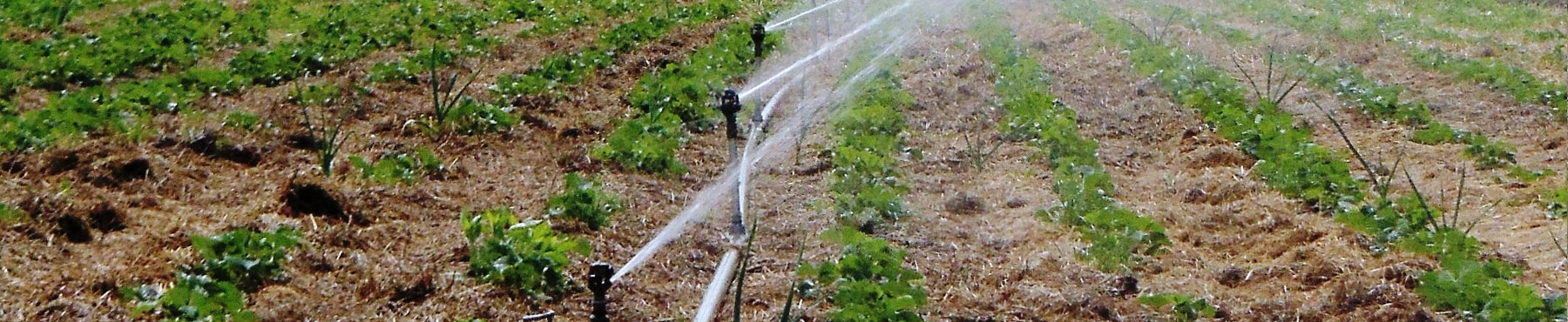
Temporary irrigation network means the network that carries out regulation within irrigated sites, composed of temporary, annually installed irrigation ditches, field (auxiliary) ditches and irrigation furrows and irrigation ditches, distribute water to fields and, when irrigating, transfer it into soil moisture of required extent. Irrigation and regulation network can also be composed of closed or mobile pipelines and mobile sprinkler plants, and of underground pipelines at subsoil irrigation.
The temporary irrigation ditches and field head ditches located on an irrigated site are cut and leveled by tractor-drawn universal ditchers as necessary.
Ploughing, harrowing, sowing, cultivation, extra nutrition, and harvesting on an irrigated site are performed by means of tractor units. Since the operational efficiency of tractor units at ploughing and other works considerably decreases at the run (pass) length of less than 400 m, it is advisable to take the area of the given site not less than 400 x 400 m2.
The requirements applicable to the temporary irrigation network. The temporary irrigation network is composed of temporary irrigation ditches, field and furrow ditches which are used for water withdrawal from delivery ditches and supply it to irrigated irrigation ditches and furrows at surface irrigation and to sprinklers at sprinkling irrigation.
Temporary canals must meet the following requirements: pass design flow; not be washed away; have no adverse slopes; command the adjacent areas; be straight; parallel to each other; and, as far as possible, parallel to the sides of the irrigated site.
Temporary canals are arranged by two schemes: longitudinal and transversal.
With the longitudinal scheme, temporary irrigation ditches are laid along furrows or irrigation ditches (perpendicularly to the horizontals), and discharge furrows – across furrows or irrigation ditches (at an acute angle to the horizontals).
Water from the delivery ditch runs through a water (drainage) outlet to a temporary irrigation ditch, from which flows to a discharge furrow, and from the discharge furrow to irrigated furrows or irrigation ditches by means of siphons, pipes, and other devices.
To avoid erosion of temporary canals the longitudinal scheme is applied on sites with a slope gradient of not more than 0.004 at an irrigation ditch discharge of up to 80 l/s and 0.003 at a discharge of over 80 l/s, since they are eroded at steeper slopes.
The length of temporary irrigation ditches are taken equal to 400-800 m for the crops requiring inter-row cultivation and 400-1500 m for narrow-row crops and grasses. The distance between them with single-sided command is 70-200 m and over, while between the field head ditches it equals the length of the irrigated furrows or irrigation ditches.
When irrigating by long furrows, the temporary irrigation ditch is allowed to operate for up to two days.
With the transversal scheme, temporary irrigation ditches are trenched across irrigated furrows or irrigation ditches at a gradient of 0.001-0.002, and water is supplied to the irrigated furrows or irrigation ditches from temporary irrigation ditches. The transversal scheme of temporary irrigation ditches layout is applied on sites with a gradient of more than 0.004.
The distance between the temporary irrigation ditches equals the length of the irrigated furrows or irrigation ditches. The length of the temporary irrigation ditches is taken equal to 400-1000 m depending on the degree of leveling-off degree of the site, irrigation ditch grade, water discharge, soil permeability.
With the transversal scheme of irrigation ditches layout the works related to bedding up and leveling of the field head ditches are excluded, the performance factor of the temporary irrigation network on the irrigated site as well as land use ratio are improved.
With the transversal scheme, permanent canals with a grade of 0.0005 for a discharge of 200-300 l/s are laid instead of temporary irrigation ditches. Water from the permanent canals is supplied through water outlets to the sections of the single-side furrow ditch from which it is distributed among irrigated furrows. With canal length of 1200-1500 m and furrow length of 300-500 m, an irrigated site with an area of 36-75 ha forms, which meets the agricultural work mechanization requirements. The discharge of 200-300 l/s is controlled by a field irrigator, who applies water at a rate of 1 ha/h.
Preparation of the areas of irrigated sites for water application. It includes: one-time-only construction leveling of the site surface; periodic operating leveling and surfacing of the field; cutting and leveling of the temporary irrigation network (irrigation ditches, irrigated furrows, and check plots); installation of reinforcing bars on the irrigation network.
When constructing or reconstructing an irrigation network, fundamental leveling is carried out according to the design.
Operating leveling is carried out periodically by using tractor-mounted buckrakes, levelers, long-span blade levelers, executing in summer or after harvesting, or in spring before sowing late crops.
Irrigation ditches are trenched simultaneously with the sowing process, and broad irrigation ditches before water application. Irrigation furrows are cut before water application.
Field head ditches and temporary irrigation ditches are cut: after sowing grain crops and grasses; before the first water application after irrigation furrows are cut; before each regular watering if ones (ditches) had partially been destroyed in the course of previous water application and cultivation processes.
Prior to water application, they prepare and install irrigation equipment: siphons; gates; dikes (closure dams); irrigation pipes and gates; weirs.
The field head ditches and temporary irrigation ditches are leveled after the last vegetative watering in every case, except for the fields under permanent grasses; before a cultivation process if the temporary irrigation ditches complicate the passage of tractors; after charging (off-season) irrigation and leaching of saline lands.
Water-diversion network is composed of canals of different orders, among which are field drains-tail ditches; land plot, on-farm, and inter-farm collectors. The highest-order section of the water-diversion network is the main collector that diverts drainage & escape waters to an intake conduit.
The water-diversion network on rice fields must perform the following functions: rapidly lower groundwater level to the level depth where it is possible to carry out mechanized operations to sow and harvest rice under saline soil conditions and mineralized groundwater; perform desalting drainage functions; provide soil leaching in the aeration zone; prevent repeated soil salinization on the fields of crop rotation with rice not covered by rice; and control redox processes in aeration zone soils. The peripheral canals of a water-diversion network must guard the areas adjacent to the rice field against flooding and salinization as well as protect the rice-growing site from inflow of groundwater and storm water to the territory of the rice growing system from outside.
Tailwater network serves for removing excessive surface water (formed at emptying canals, in emergency cases, at downpour, etc.) out of irrigated lands and is placed orienting by lower check points of the irrigated lands.
The tailwater network (in an irrigated zone) is the system of the ditches and facilities designed for intake and transit pass of mud stream, emergency, storm waters, as well as for diverting excessive water from canals and out of fields; it is a component of the irrigation system. In submountain areas, natural depressions (ravines, gullies) serve as tailwater networks; only in depressions with large catchment basins (sais) and frequent mud torrents, special discharge ditches (waste ditches/escape ditches), anti-mudflow structures (dams, dikes, water outlet conduits, spillovers). Local discharge of melt water, storm water, and irrigation water from fields and canals inflows to natural depressions, where it partially evaporates, percolates deep into ground and partially comes to downstream irrigation networks. On ravine and delta lands that are bad in terms of ameliorative conditions, collector and drainage network acts as drainage network.
The tailwater network represents the system of ditches designed to remove excessive surface and drainage waters out of irrigated lands. The tailwater network consists of: interception drains meant for catchment and diversion of surface water; emergency water removal and tail escapes for emptying permanent irrigation canals; water outlets that collect and divert excessive surface water.
Interception (catchwater) drains are laid upstream irrigated lands, while emergency water removal and tail escapes as well as water outlets orienting by lower check points of the topography. The routes of waste ditches are advisable to be laid on water users’ boundaries and link with the location of the distribution network. Escape structures are also arranged in particularly dangerous places along the main canal and main distributors; to empty those, they use flood gates which are arranged, as appropriate, opposite natural thalwegs. If such facilities are absent, they make waste ditches that connect the flood gate with an intake conduit.
The water-collecting & escape network of ditches is designed to organize catchment and diversion the following waters from the area of the irrigation system: surface flow (storm and melt water); water from distributors and irrigation ditches at process water disposal, emptying, and disasters; waster water from fields at surface irrigation and sprinkling irrigation.
Water-collecting & escape network is supposed to provide timely water diversion to an intake without violating the operation mode of irrigation system facilities and flooding irrigated lands, have minimum length and number of intersections with irrigation and collector & drainage network, communications. It is designed to be placed along the boundaries of irrigated sites, crop-rotation fields, as a rule, on subdued topographical features (backlands).
Water-collecting & escape network consists of:
• field catchment areas that collect excessive water from fields;
• conducting wasteway channels that divert water from field catchment areas, emergency water removal and tail escape structures on canals;
• enclosing canals that protect irrigated lands against inflow of surface water from upstream areas.
Field catchment areas represent generally furrows cut at the low field edge which divert out the water collected to a lower-order waste ditch which is usually overlapped with a ditch of a field road.
A high-order escape network may consist of earth (unlined) canals, conduits. To divert water from the pipe network, they lay discharge conduits that run from discharge wells on irrigation pipelines to the closest waste ditch at the field boundary.
The highest surface flow rate of 10% water availability in the territory of the irrigated site or surface flow at irrigation is taken as the design flow rate in the canal of the water-collecting & escape network depending on the location and order of the canal.
The design flow rate of the emergency discharge from the main canal is equal to 0.5Qmax in the emergency discharge canal.
The design flow rate in water-collecting & escape ditches is taken as equal to not more than 30% of the total maximum discharge flows from simultaneously operating irrigation canals that discharge water to those. The design water flow of tail escapes for earth canals is taken as equal to 0.25-0.5 of the maximum discharge flow in permanent irrigation canal at the end section. In some cases, water-collecting & escape/waste ditches are checked in terms of passing melt or storm water from the areas they service.
Ditch parameters are set according to the maximum flow rate at uniform operation regime. Passage of design maximum flow rates through the canal is provided for a water level 15-20 cm below the ground surface.
In rice-growing irrigation systems, they necessarily design a water-diversion (escape) network for which maximum and minimum flow rates are set.
The water level in the water-diversion canal of all orders is designed for 0.5 m lower the surface level of the lowest check adjacent to it.
Purpose and location of the water-collecting & escape network. At downpour, irrigation with discharge, emptying canals after irrigation, and water seepage from canals, surface runoffs collect in the irrigation systems located in depressions. They feed groundwater and may serve as the malarial mosquito breeding site. To remove excessive surface runoff, they construct a water-collecting & escape network in the form of open canals.
Waste ditches are arranged on natural depressions with maximum use of thalwegs by the beeline to the water intake along existing roads regardless of side ditches and by side ditches, along water-use boundaries, and along distribution canals.
On-farm waste water is diverted to the farm’s tail ditches, and the water from the latter is diverted to the main tail ditch. The least distance between two waster ditches is taken as 800-1200 m and twice as much at double-sided command of distributors.
Irrigation ditches with a flow rate over 250 l/s end not in dead end but in escape structures through which water comes to waste ditches.
In large inter-farm distributors, main canals and their branches, except for tail escapes, emergency distributors are made. If large irrigation canals are arranged across natural slopes, interception drains are made on their upstream parts, which serve for catching flood and storm waters.
Design and calculation of ditches. Water-collecting & escape ditches are built in groves and, as a rule, with trapezoidal section. The elements of ditch cross-section are determined by hydraulic calculation. The bottom width is calculated and taken as 0.3 m at least, and depth as 0.8-1 m. At maximum flow rates, the flow velocity in ditches should be lower than the erosive velocity and higher than the silting velocity so that to avoid erosion, silting, and weeding of the ditches.
At design flow rates, the water level in waste ditches is to be 15-20 cm above the ground surface, making provision for discharge of surface runoff from the lowest sites. The water level in a higher-order water-collecting & escape ditch should be at least 5 cm lower the water level in a lower-order waste ditch.
The design flow rate of tail escapes for earth canals are taken as 0.25-0.5 rated flow rate of the permanent irrigation canal at the end site. The design flow rate of collecting ditches is taken of up to 30% of the gross rated flow rates of simultaneously operating irrigation canals that discharge water into this water-collection canal.
Discharge/outlet works to drain water from irrigation canals at the end of the distributors and in the places of disaster discharge. Bridges and pipelines are constructed in the places of crossing of the waste ditches with roads; pipelines and inverted siphons (pipe canals) at the places of crossing with irrigation canals; and check drops and inclined drop structures at the steep-gradient sites.
Lock-weir and drainage network is built up to protect against flooding and waterlogging and possible salinization of soils on irrigated areas. In combination with the irrigation network, it provides bilateral control of the soil water regime.
Lock-weir and drainage network includes:
• intercepting drainage system canals, i.e. interception drains/ditches, interception and catch-water drains, catch-water drains, which prevent entry of surface and ground waters to the irrigated site;
• main discharge/wasteway canal, or collector, laid at the lowest levels of the irrigated area and diverting discharge and drainage waters from the irrigated land;
• inter-farm escape/wasteway canal, or collector, which receives and diverts discharge and drainage waters from farms’ territories;
• farm escape/wasteway canal, or collector, which receives and diverts discharge and drainage waters from the territory of a single farm;
• inter-plot or inter-brigade escape/wasteway canal, or collector, which receives and diverts discharge and drainage waters from the territory attached to crop-rotation or brigade land plots;
• plot or brigade escape/wasteway canal, or collector, which receives and diverts discharge and drainage waters from the territory attached to a single crop-rotation or brigade land plot;
• small-scale lock-weir network: irrigation plan, check, plot organized at small plots.
Man-made structures represent hydraulic facilities on all canals to regulate and control water in the system.
Man-made hydraulic structures on irrigation system canals are needed to control water flow rate and level in particular parts of the system as well as the velocity and quality of the water delivered. Among water conveyance/passageway structures are flumes, tunnels, aqueducts, inverted siphons (pipe canals), and inclined drop structures.
Flumes are man-made channels with various cross-sections; their bottom is placed on the ground or on special supports, trestle bridges. Water motion there is generally of free flow nature. Aqueducts represent bridge-type hydraulic structures made from precast or cast-in-situ reinforced concrete, which form man-made channels (dikes) above surface depressions (ravines, roads, inverted siphons/pipe canals, etc.). The most important place is the place of connection of the aqueduct with a canal. Here, erosion, seepage, and destruction of canal sections may easily happen. Therefore, pile retaining and sheet-pile walls cut into the bottom and side slopes to a depth of not more than 0.8-1.0 m.
Inverted siphons are hydraulic structures that represent water conduits serving to pass water under a channel or when crossing a deep valley or road. The pressure required for water to move is created due to the difference in the inlet and outlet holes. The Inverted siphon can be with one or several pipes.
Water supply is regulated by means of offtake regulators, which also regulate water elevation and velocity (being equipped with flow meters). There are offtake regulators of open (man-made channel/flume bounded by sidewalls and equipped with gates of different design) and closed (pipes) types.
Check drops are conjugation structures of open or closed design for passing water and dissipating energy at a short distance. There are cascade-type (open-conduit drop, baffled outlet drop, and closed conduit drop) and cantilever-type drops.
Inclined drop structures are man-made channels with gradient that is more than the critical which connect different-level canal sections.
Among control structures are spillways and water outlets as well. They are installed both at the head and tail sections of the canal. They are designed for water discharge in case of overfilling and for water evacuation.
Spillways are installed on permanent canals.
Water outlets (fixed and portable) serve for water delivery from permanent canals to temporary irrigation ditches.
The following structures are placed in the closed network: distribution pots (for regulating water supply) with manual or automatic control; irrigation valves; sinks (in depressions); air valves (in highest points of the route); dashpots (in the pressure pipeline after a valve; at each 2-3 km along the pipeline).
Man-made structures in the irrigation network
The following hydraulic facilities are installed in the irrigation network in order to provide water control, measurement, and management: water outlets; water-retaining structures; grade-control structures; and water conveyance structures (aqueducts).
The hydraulic facilities in the irrigation network are broken down into cast-in-place, precast, and combined types.
Cast-in-place structures are built from concrete, reinforced concrete, stone, wood, while precast ones from separate fabricated blocks.
Combined structures are installed on site, and their particular parts are mounted from prefabricated blocks.
Structures on canals can be of closed (piped) and open types.
Water outlets (regulators) are mounted in the head of permanent irrigation canals (distributors) and on temporary irrigation ditches. Water outlets are built with and without crossing. If the canal route has steep slope, water outlets are combined with check drops or inclined drop structures. To regulate water level and flow rate, water outlets are equipped with plain or sector gates. Pipe outlets (closed-conduit waterways) have usually round and sometimes square or rectangular cross-section.
Water-retaining structures (check dams) are arranged on inter-farm and large farm canals. The purpose of these structures is to keep required water level in canal at water discharge below Qnorm.
Grade-control structures are installed at the places with considerable slope of canal route. Flow velocity in the earth canal will exceed admissible scouring rates. Inclined drops, cantilever-type (lip) drops, and shaft-type (cylinder) drops are used as grade-control structures.
Water conveyance structures are built in the places where water needs to be transported over some obstacles or where construction of earth canals would be difficult from the technical or economically impractical. Among such obstacles are gullies, ravines, rivers, deep valleys, canals, roads, etc. Inverted siphons, aqueducts, flumes, pipe culverts, and tunnels are qualified as water conveyance structures.
The inverted siphon is a pressure pipeline constructed where a canal crosses a natural or man-made obstacle. It consists of culvert inlet and culvert outlet as well as pressure pipeline. Most often factory-made reinforced-concrete, more rarely asbestos-cement or steel pipes are used for inverted siphons. At higher capacity, inverted siphons are usually made from cast in-situ reinforced concrete. The number of inverted siphon pipe sockets or runs depends on the discharge of the water passed. At the inverted siphon’s culvert inlet, service or repair gates as well as trash-rack structures are installed. The flow velocity in inverted siphons varies from 1 to 4 m/s; it should be higher that the silting and average flow velocity.
The aqueduct represents an elevated flume. It consists of culvert inlet and culvert outlet as well as a flume with supports. At present, aqueduct flumes are as a rule made from cast in-situ reinforced concrete or precast reinforced concrete. Piles, rack-mountable frames with foundations, land abutments, etc. are used as supports. Flow velocity in aqueducts is set within the range of 1.0-2.5 m/s. Prefabricated circular culvert aqueducts made from reinforced concrete are installed at the places where an irrigation canal crosses bodies of roads or canals.