Land degradation is a process in which the value of the biophysical environment is affected by combination of human-induced processes acting upon the land. Also environmental degradation is the gradual destruction or reduction of the quality and quantity of human activities animals activities or natural means example water causes soil erosion, wind, etc. It is viewed as any change or disturbance to the land perceived to be deleterious or undesirable. Natural hazards are excluded as a cause, however human activities can indirectly affect phenomena such as floods and bush fires.
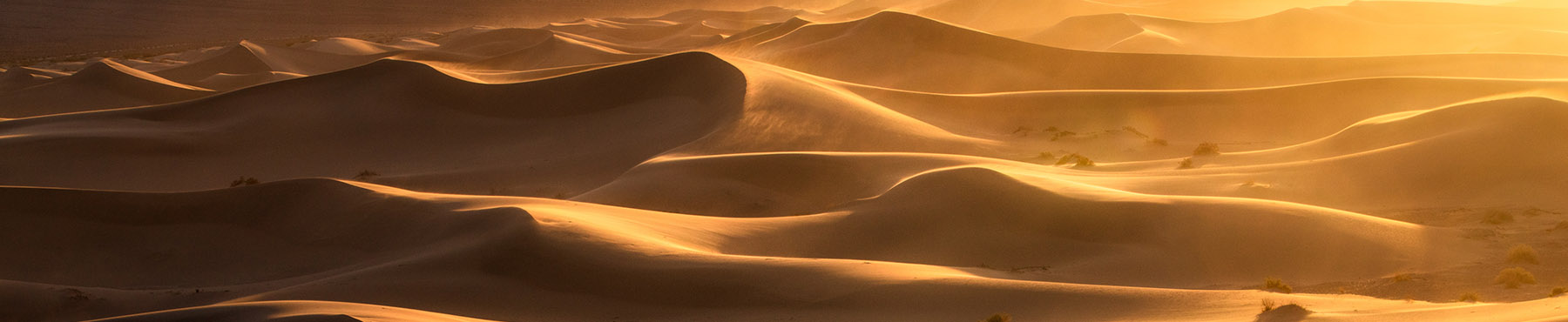
Desertification — process of fertile irrigated lands transformation into dry dead desert with loss of fertility and vegetation.
Water shortage — water resources deficit for biological needs of agricultural crops and other vegetation for their normal growth as well as environmental requirements for ecological processes stabilization.
Draught — durable year season with lack of precipitation under high air temperature.
Climate aridization — climate dryness strengthening due to air temperature increase, evaporability and precipitation reduction i.e. Trentwait air moisture deficit and humidity coefficient reduction
Forest cutting — deforestation leading to violation of snow and rain water accumulation. Besides, soil erosion and galleys creation occurs.
Overgrazing — vegetation abolishing due to grazing norm overcoming. It leads to soil moisture stock reduction formed under lack of rainfall.
Biological death — vegetation necrosis due to sharp violation of its water demand and toxic matters concentration in soil and atmosphere increase.
Lack of drainage — lack of natural ground water outflow; artificial drainage for ground water table rise, water logging and salinization.
Salt accumulation under artesian water impact. Salt accumulation in root layer or aeration zone at expense of their transfer by ground water. Artesian head in aquifers with high permeability is over ground water table creating water and salt overflow into upper fine-grained layer (unsaturated zone). Salt accumulation depends on artesian water overflow intensity, salt stocks in upper layer and ground water salinity. Under this condition salt profile is being formed in aeration
Salt accumulation on irrigated fields under salt balance violation. This type of salt accumulation is formed on irrigated fields when inflow consists of water supply, percolation from irrigation canals, ground water contribution and prevails over outflow (total evaporation, overflow from unsaturated zone in ground water) under deficient natural and artificial drainage.
Salt accumulation caused by inflow from higher elevated area. This type of salt accumulation is formed at expense of salt transfer by ground water in cones of withdrawal where ground water is discharged. Salt accumulation intensity depends on soils and rocks salinity of above territories and ground water salinity. This type is typical for large depressions located on plains.
Salt accumulation under technogenic processes. Salt accumulation is formed due to mines, plants and enterprises wastes where water without treatment are released to galleys and collectors.
Salt accumulation under wind activity. This type is created due to wind transfer of different kind of dust and salt. Sources of this can be salt deserts, semi-deserts, dried sea bed and salts within irrigated lands.
Ground water table lowering. Ground water table lowering due to water resources exhaustion and sea bed and water bodies desiccation. As example Aral sea bed can be taken.
Irrigation cessation. Irrigation can be stopped due to lack of water resources and low land fertility.
Water body balance violation. Water body balance violation very often occurs because of water resources deficit. Near 200-250 small water bodies and lakes were dried in the Aral sea basin.
Ferttility losses. Very often occurs due to land salinization and water logging under lack of drainage and poor agricultural production management. This type of desertification is typical for irrigated lands located in river deltas.
Salinization. Saline soil — non-alkaline soils containing high concentration of soluble salts preventing agricultural crops growth. Types of salinization are as follow:
• Primary soil salinization — natural salt accumulation in the soil due to ground water evaporation, bedrock salinity as well as biogenic, eolic and other factors.
• Secondary soil salinization — salt accumulation due to soil water regime changes, i.e. poor irrigation management. Secondary salinization can occur in non-saline soils. Most often secondary salinization is caused by salt influx from ground water
Deforestation is abolishing or decreasing geographic landscape consisting of aggregate of trees, bushes and grass plants caused by human activity.
Land degradation (including pastures) is land properties, productivity and fertility deterioration under human activity.
Main reasons for land degradation in the Aral sea basin are the following: durable draughts, ineffective water use for irrigation, overgrazing, flow up of humus, inexpedient chemicals application.
Drying of the seabed and water bodies is water level lowering in result of water resources exhaustion and water discharge prevailing.
Soil salinity degree is evaluated by soil abstract analysis or by electric conductivity. Main criterion is salt concentration and ration of various ions. soil salinity can be divided into 5 categories: non-saline, slightly saline, medium saline, strongly saline and very strongly saline.
Trees density and their types changes. It is necessary to consider vegetative formations consisting of different groups of green plants. V.Willyams distinguishes the following groups:
• Wood deciduous and coniferous vegetation
• Meadow grass vegetation.
• Steppe grass vegetation).
• Desert vegetation(ephemeric).
Soil bonitet — comparative assessment of soil quality as agricultural production mean. Criteria are as follow: humus horizon thickness, nutrient elements concentration, pH, chemical composition, salinity.
Desiccation area — area of the sea or water body dry bed as result of water level lowering. Main criterion is area of dry sea bed (m2, km2 or %).
... of soil salinization
Ground survey — soil sampling from various horizons of soil profile for further chemical analysis. Ground survey should be conducted twice a year (spring and fall).
Remote sensing of soil salinity — is taking picture from plane or satellite. Obtained information is interpreted for mapping purposes.
...of deforestation
Ground monitoring — ground observation of vegetation and geo-botanic mapping.
Taxation — plant taxonomic categories apportionment including associations, group of associations, formations, group of formations, class of formation, type of vegetation, sub-types, species, etc.
Remote monitoring is satellite images use vegetation cover study and geo-botanic mapping.
Monitoring periodicity is 3-5 years (by Nature Protection Committee and Ministry of Agriculture).
...of land degradation
Ground monitoring consists of field investigations (soil profiles, sections, pits) and soil laboratorial analysis (including genetic division, moisture, erosion, nutrient elements).
Mapping is one of methods to study soil cover and is basic information for agronomists, civil engineers and irrigators. Map can be: general (scale 1:1 000 000); small scale (1:1 000 000-300 000); medium scale (1:300 000-100 000); big scale (1:100 000-1:10 000).
Ground monitoring periodicity —5 years (by Ministry of Agriculture)
Remote monitoring — aero and satellite images use for soil mapping
Theoretical base of remote sensing is law of correlation between soil properties, vegetation cover and environment. Soil surface is always covered by vegetation. Because of that vegetation composition determined imaginary character.
...of drying bed
Desiccated bed monitoring — dry bed area systematic observation and control by ground and remote methods.
Remote sensing — use of aero and spatial information for mapping and aquatic surface area measuring.
Ground observation — depth measuring by altimeter and bed relief map preparation
Monitoring periodicity — each year by national Hydrometeoservices.
Monographs and brochures
Agenda 21, Chapter 12 - Managing Fragile Ecosystems: Combating Desertification and Drought (1992) 
Agricultural drought monitoring and yield loss prediction method - Briefing Note (GWP CEE, 2015)
Drought Risk Management Scheme - a decision support system - Technical Note (GWP CEE, 2015)
Drylands in Central Asia: Approaches for Solving Outstanding Issues (CAREC, 2015)
Kazakhstan: Issues and Approaches to Combat Desertification (2003)
Kyrgyz Republic: Issues and Approaches to Combat Desertification (2003)
Tajikiistan: Issues and Approaches to Combat Desertification (2003)
Turkmenistan: Issues and Approaches to Combat Desertification (2003)
Uzbekistan: Issues and Approaches to Combat Desertification (2003)
Papers
Irrigation and Development of the Dzhizak Steppe (1976)
Irrigation and Development of the Karshi Steppe (1976)
Agreements at the global and regional levels
Advisory documents and guidelines
Guidelines for preparation of the Drought Management Plans (GWP CEE, 2015)