Search
Map
Русский
Home
News
Knowledge Base
Tools
Projects
Organizations and Processes
Syr Darya
Knowledge base
To the beginning of the section
Maps and diagrams of the Syr Darya river basin
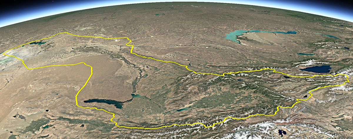
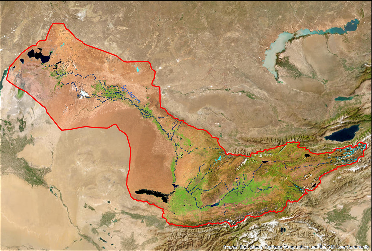
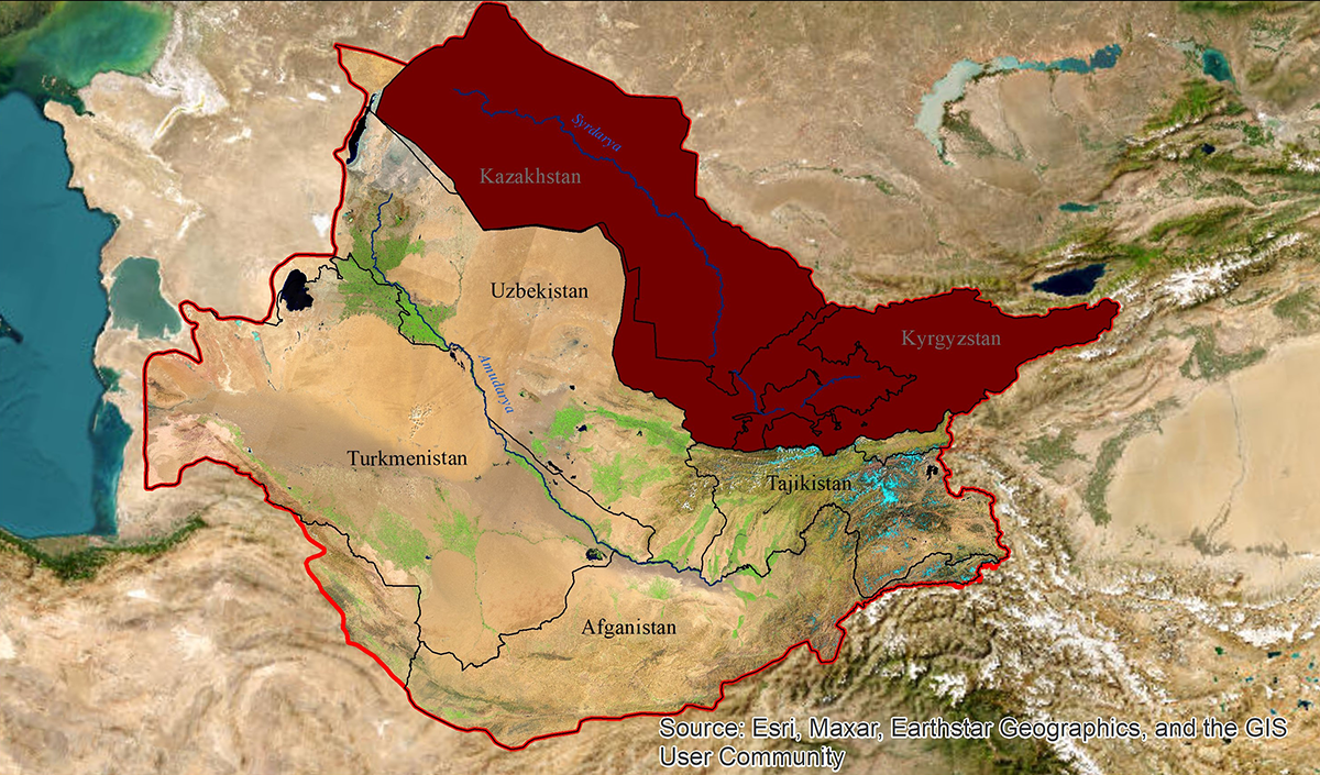
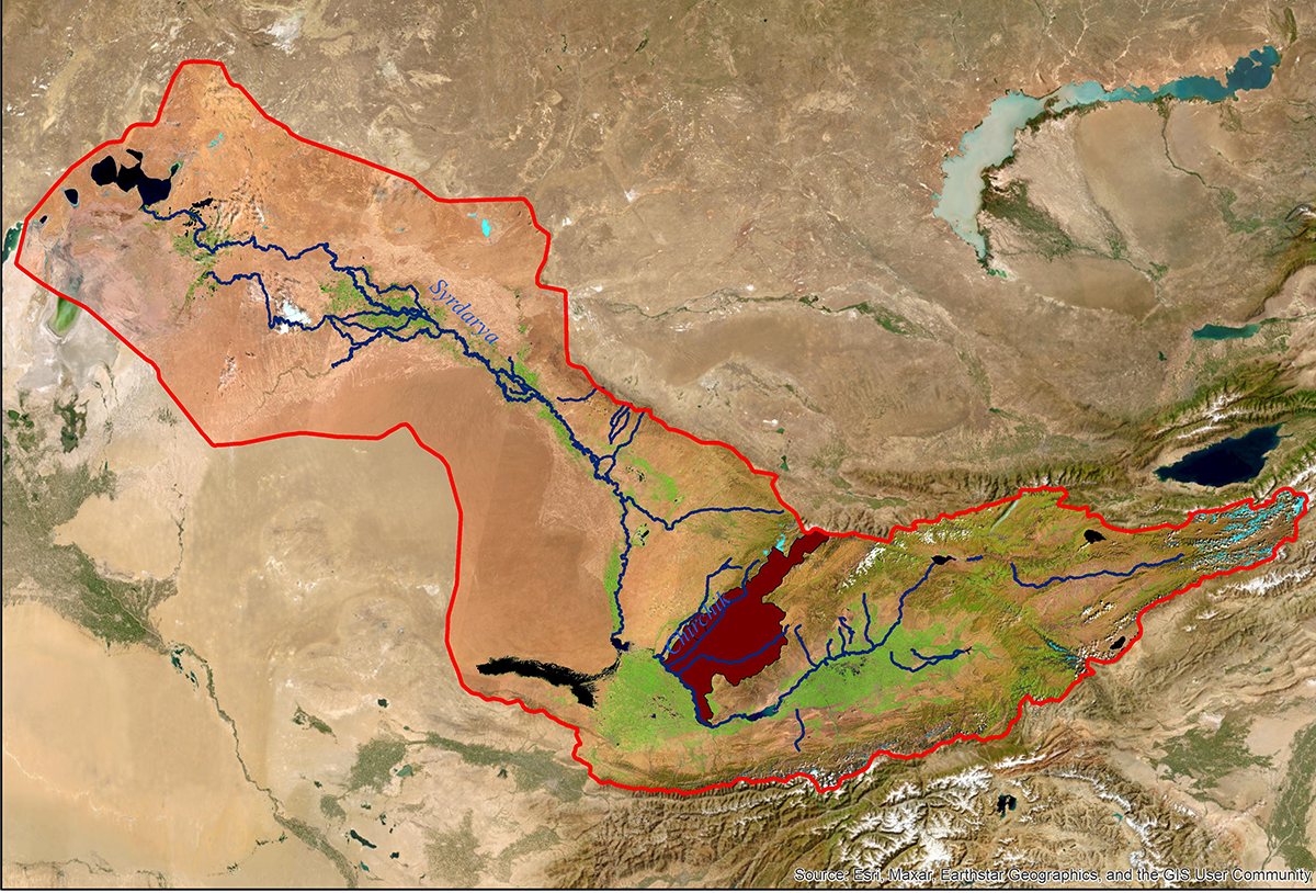
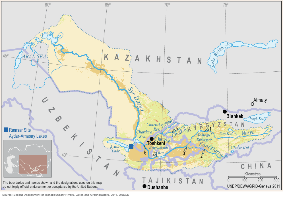
Syr Darya river basin map based on satellite images
Syr Darya river basin map based on satellite images
Location of the Syr Darya basin in the Aral Sea basin
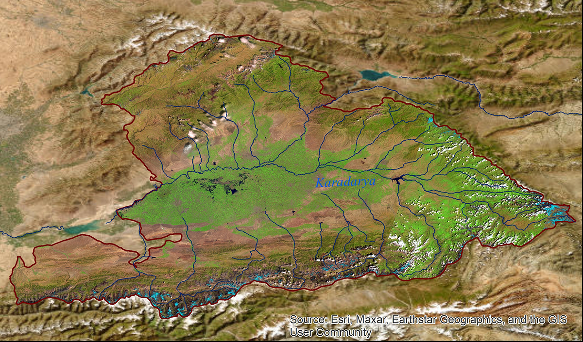
Karadarya river basin map based on satellite images
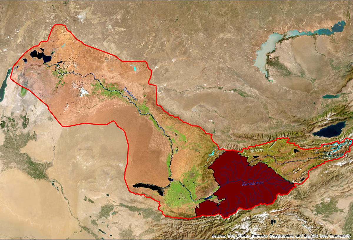
Location of the Karadarya basin in the Aral Sea basin
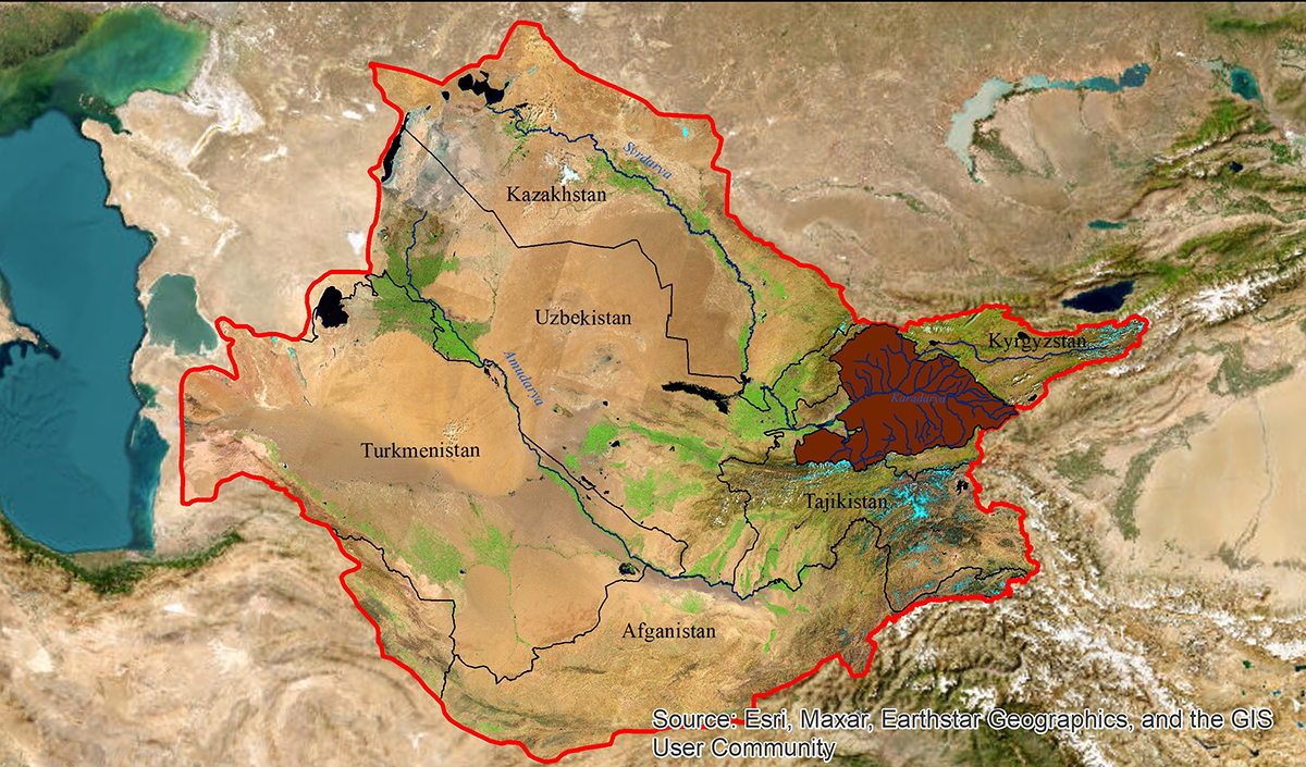
Location of the Karadarya basin in the Syrdarya river basin
Chirchik river basin map based on satellite images
Location of the Chirchik basin in the Aral Sea basin
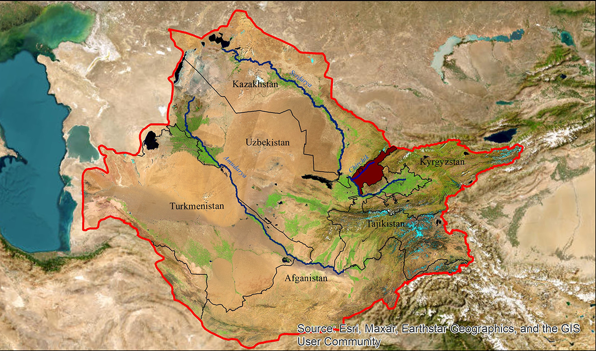
Location of the Chirchik basin in the Syr Darya river basin
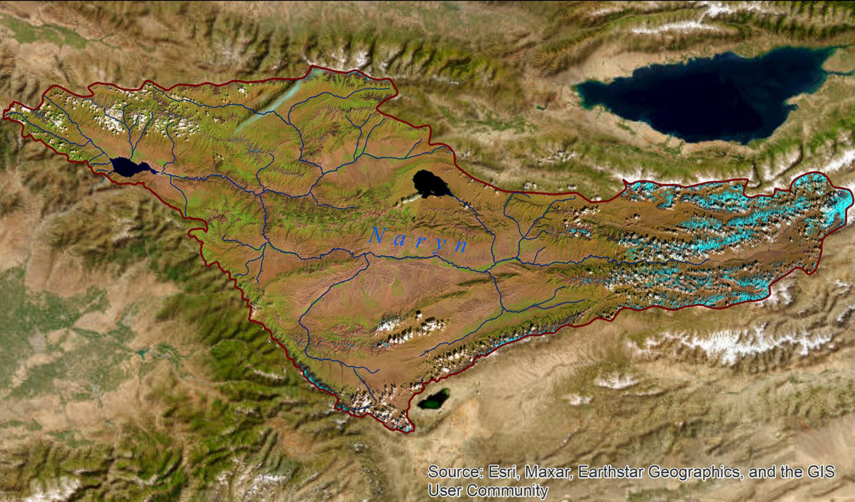
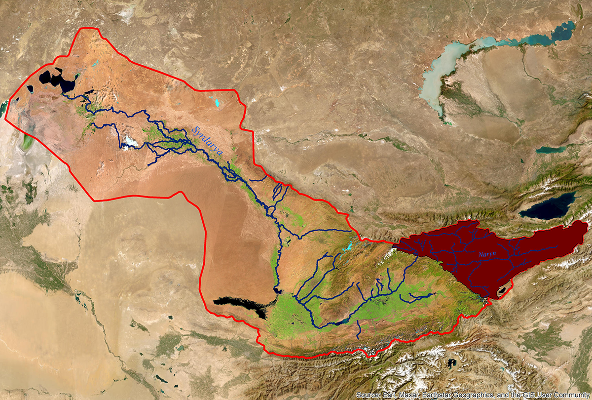
Naryn river basin map based on satellite images
Location of the Naryn basin in the Aral Sea basin
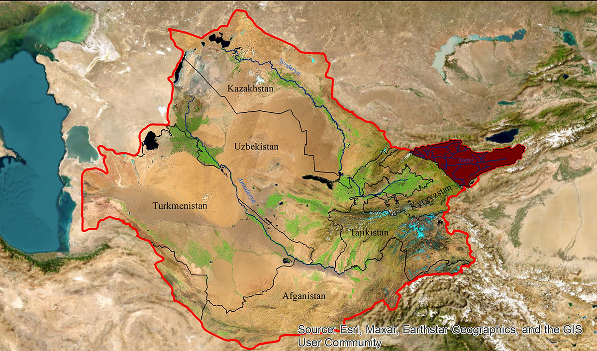
Location of the Naryn basin in the Syr Darya River basin
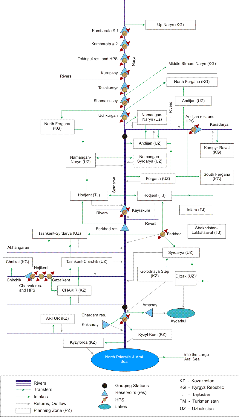
Syr Darya river's linear scheme
Syr Darya river's linear scheme: probable scenario and risks
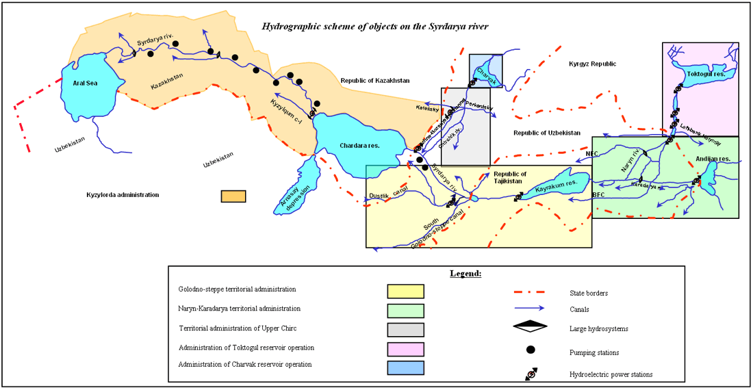
Hydrographic scheme of Syr Darya river
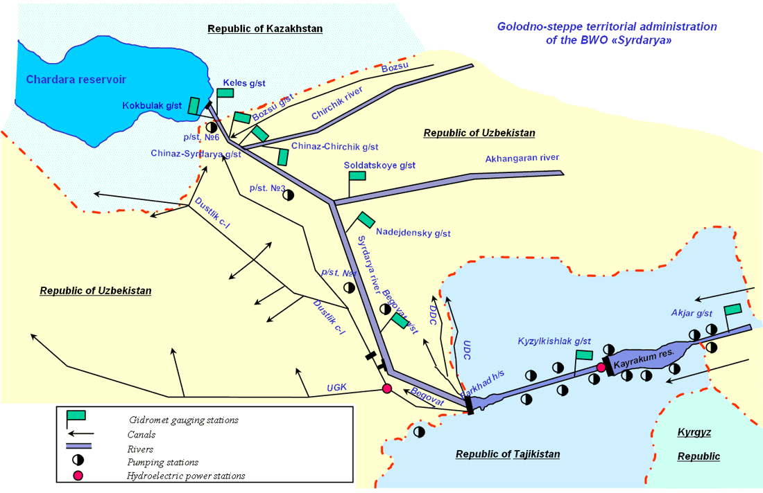
Golodno-steppe territorial administration
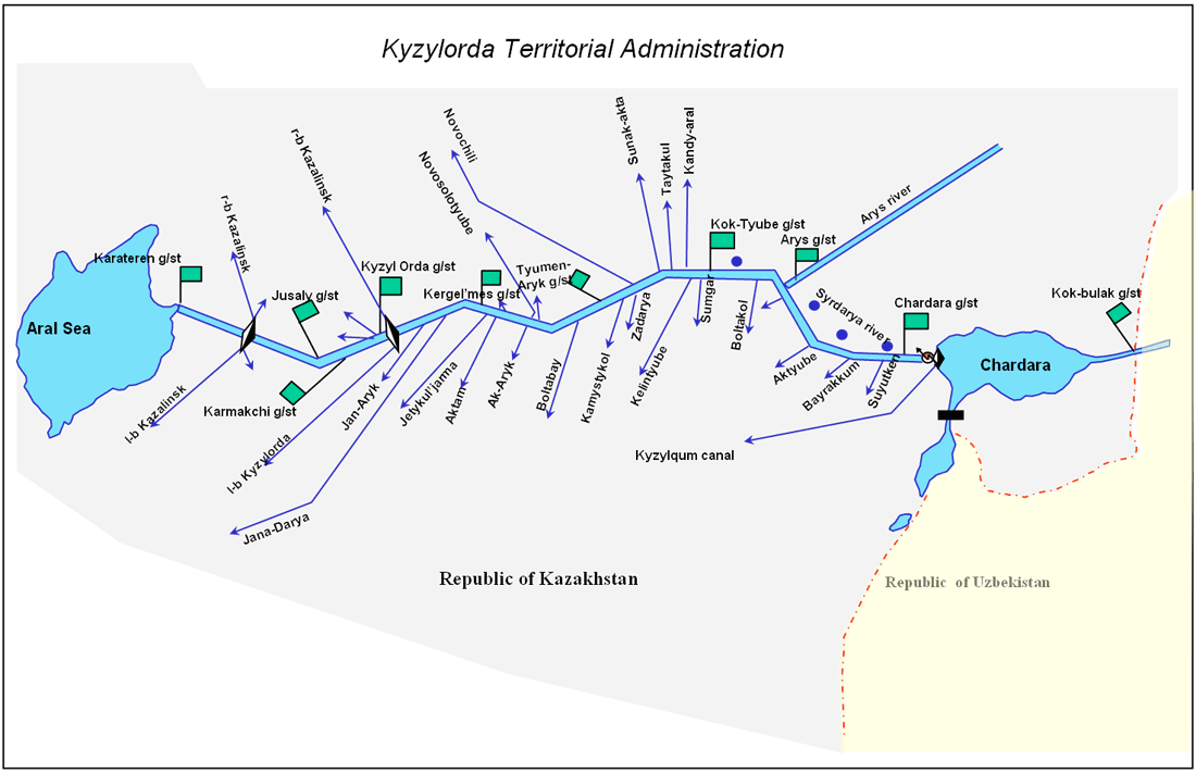
Kyzylorda Territorial Administration
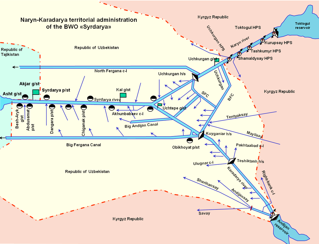
Naryn-Karadarya territorial administration
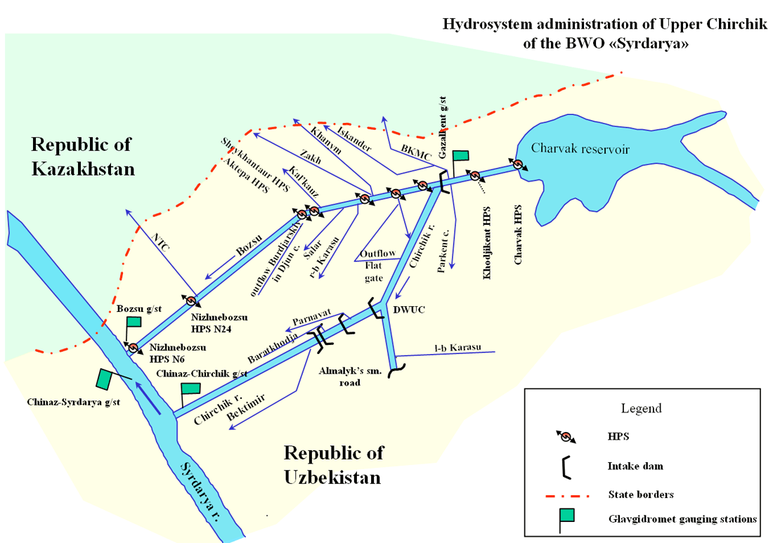
Upper Chirchik territorial administration
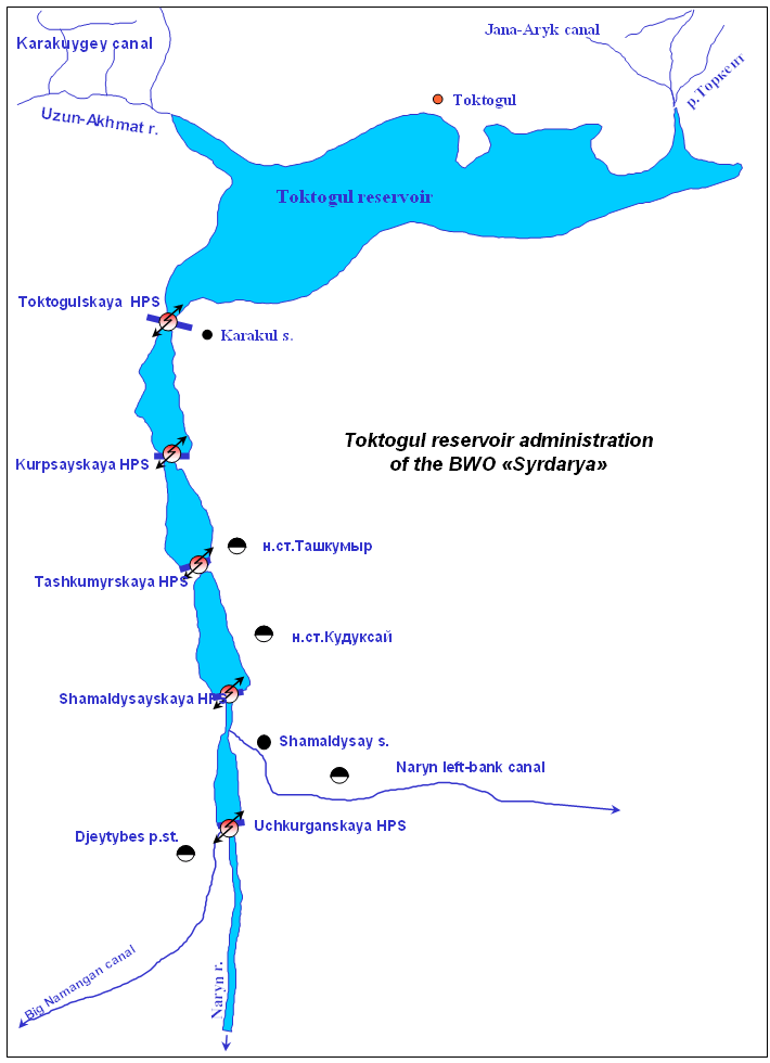
Administration of Toktogul reservoir
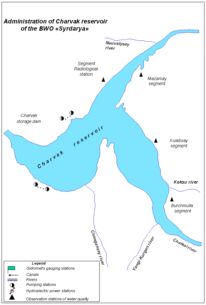
Administration of Charvak reservoir
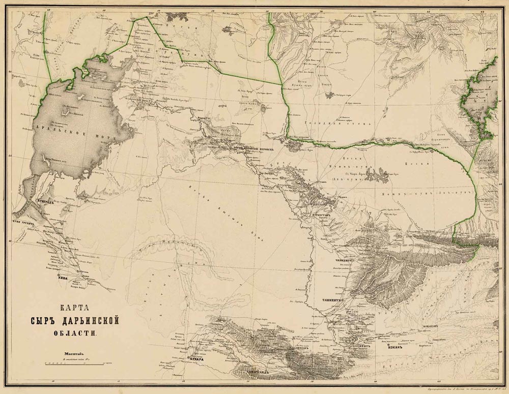
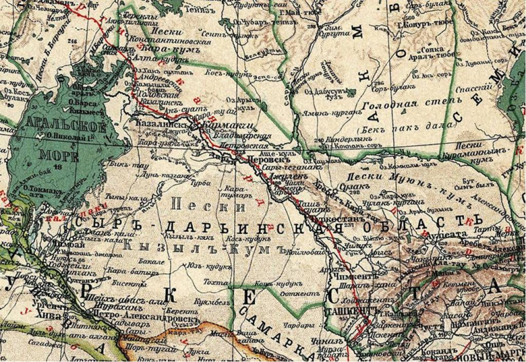
Historical map of the Syr Darya region
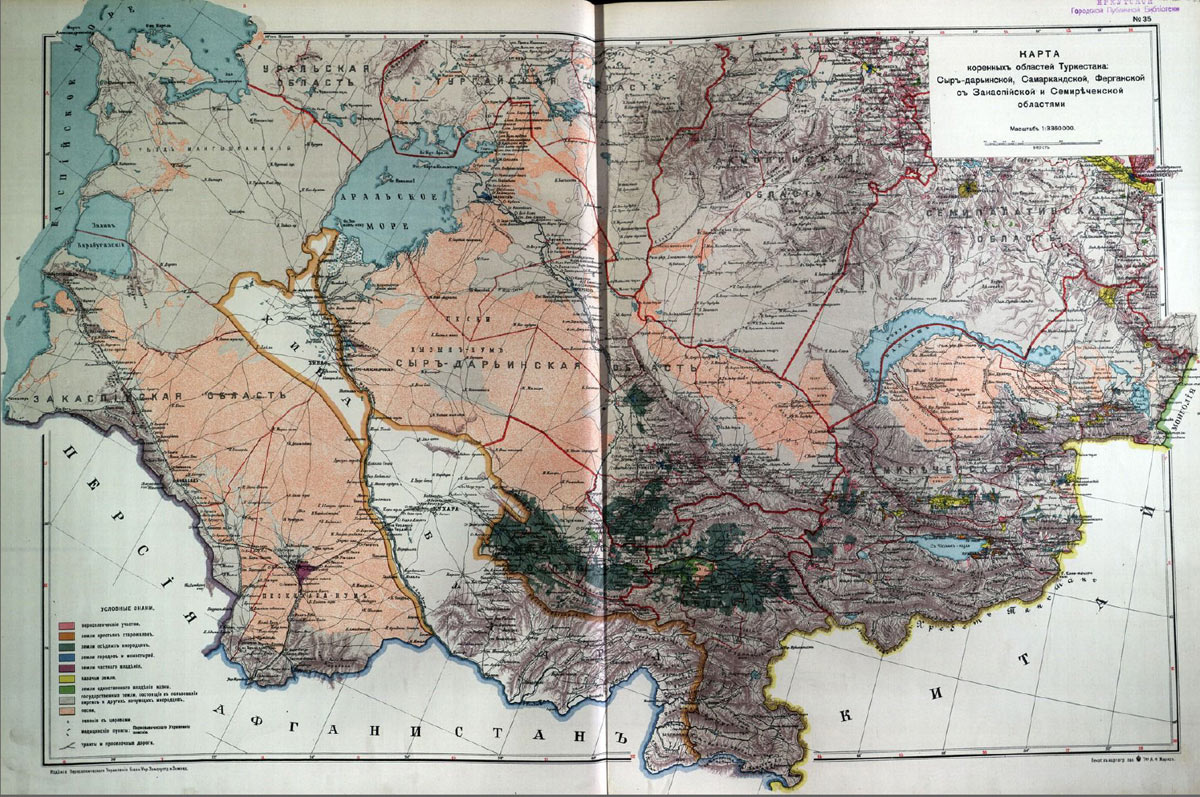
Map of Turkestan: Syrdarya, Samarkand, Fergana, Transcaspian and Semirechye provinces (1914)
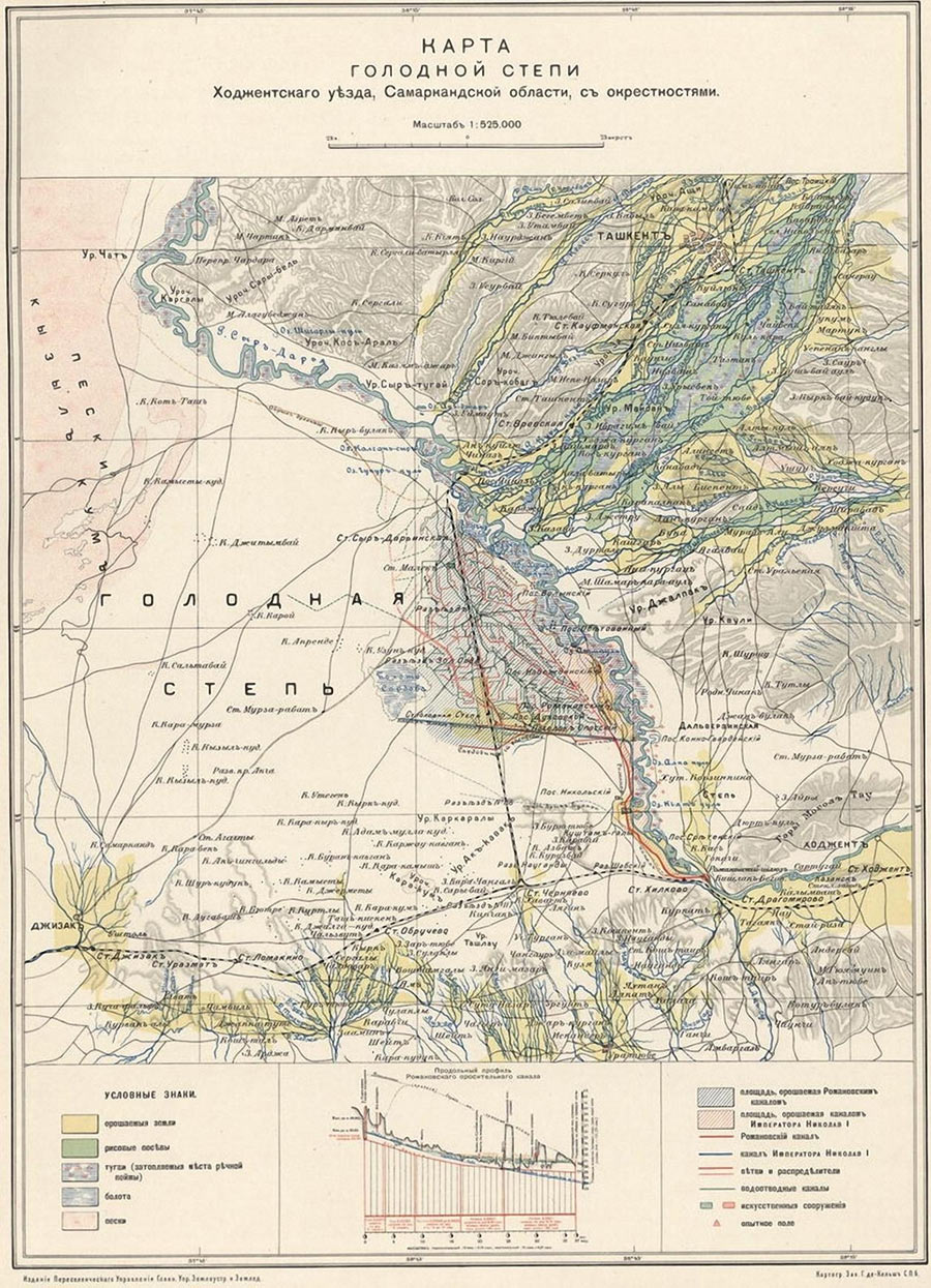
Map of the Hungry Steppe (1925)
Map of the Hungry Steppe
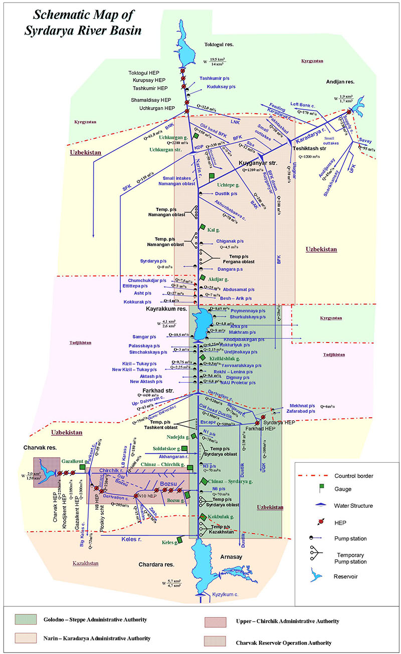
Syr Darya river basin map