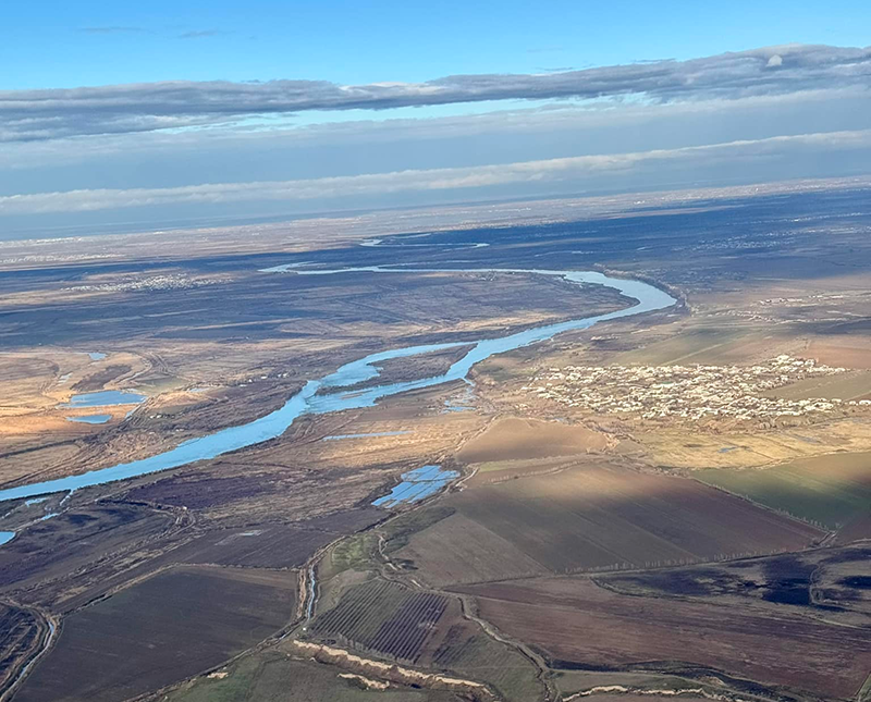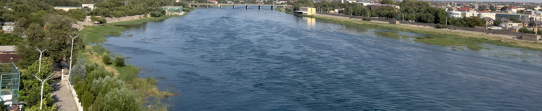
The Syr Darya river, formed by the junction of the Naryn and Karadarya rivers, is the longest river and the second largest rivers in terms of water content in Central Asia and Aral Sea basin. The length of the river is 3,019 km from the headwater (and 2,212 km from the junction point), while the catchment area is 219,000 km2. Average annual Syr Darya basin flows for the last years are 40.8 km3. Owing to unique Syr Darya water system it is feasible also to use 6.7 km3 of return waters.
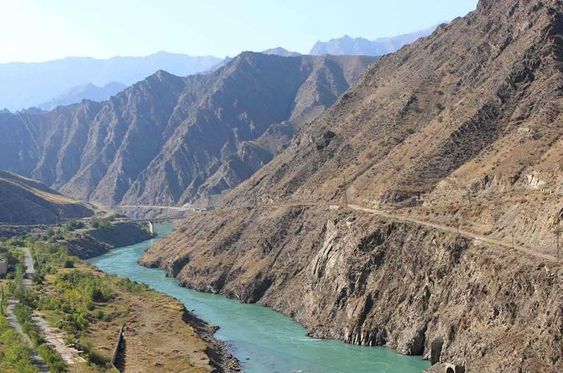
The Naryn rises in the Tian Shan mountains in Kyrgyzstan, Central Asia, flowing west through the Fergana Valley into Uzbekistan. It is 807 kilometres long (together with its upper course Chong-Naryn) and drains a basin area of 59,100 square kilometres. It has an annual flow of 13.7 cubic kilometres.
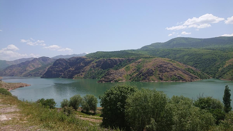
The river contains many reservoirs which are important in the generation of hydroelectricity. The largest of these is the Toktogul Reservoir in Kyrgyzstan containing 19.9 cubic kilometres of water. Dams downstream of the Toktogul in Kyrgyzstan include: Kurpsay, Tash-Komur, Shamaldy-Say and Uch-Korgon. Upstream of Toktogul in Kyrgyzstan are the Kambar-Ata-2 and At-Bashy Dams while the Kambar-Ata-1 Dam is in planning stages.
The Akhangaran, also known as Angren, is a river in Tashkent Region of Uzbekistan. The river is 223 kilometres long, and has a basin area of 5,260 square kilometres.The Akhangaran is a right tributary of the Syr Darya.
The Keles is a river of southern Kazakhstan (Turkistan Region) and for a short stretch near the town Keles also in Uzbekistan. It is a right tributary of the Syr Darya. It is 241 kilometres long, and has a drainage basin of 3,310 square kilometres.
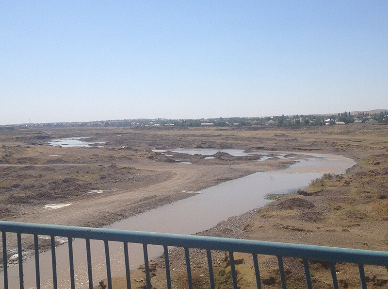
Hydrographical scheme of Syr Darya divides all basin of this river on three parts:
• Upper watershed mountain area (sub-basin of Naryn, Karadarya, small tributaries and part of Chirchic), where flow is formed and the water consumption is minimal; zone of potential hydropowerresources;
• Valley of Syr Darya and part of Chirchik on proluvial and alluvial planes
• main part of settlements, irrigated area and oaseses;
• Lowlands — Aral Sea coast and deltas.
Common water resources of Syr Darya river are 37.2 km3 from which transboundary waters — 27.6 km3, from which operates and allocates by ICWC — 21.1 km3. Especiality of water resources of Syr Darya river that return flow, which appears back to river achieves in average year 70% from intake to uppershed reservoirs (it include also side flow of some small rivers). Presence of this return flow permits to satisfact in multiwater and average year requirement of the water management subregion without multiyear regulation and only in low-water year we need to involve reserves of water from them.
Average multi-year resources of transboundary river flow in the Syr Darya river basin (km3/year)
| Source, river basin | The state, where it is formed | Total | ||||||||
| Kyrgyzstan | Kazakhstan | Tajikistan | Uzbekistan | the Syr Darya basin | ||||||
| Total | Transb. | Total | Transb. | Total | Transb. | Total | Transb. | Total | Transb. | |
| Naryn | 14.544 | 12.831 | — | — | — | — | — | — | 14.544 | 12.831 |
| Karadarya | 3.921 | 2.060 | — | — | — | — | — | — | 3.921 | 2.060 |
| Rivers of Fergana valley | 6.040 | 5.400 | — | — | 0.855 | 0.700 | 0.910 | 0.800 | 7.805 | 6.900 |
| Rivers of midstream | — | — | — | — | 0.150 | — | 0.145 | — | 0.295 | — |
| Chirchik | 3.100 | 3.100 | 0.749 | 0.749 | — | — | 4.100 | 2.000 | 7.949 | 5.849 |
| — |
— |
— |
— |
— |
— |
0.659 |
— |
0.659 |
— |
|
| Keles | — | — | 0.247 | — | — | — | — | — | 0.247 | — |
| Arys | — | — | 1.183 | — | — | — | — | — | 1.183 | — |
| Rivers of downstream | — | — | 0.600 | — | — | — | — | — | 0.600 | — |
| Total, km3, the Syr Darya river basin (%) | 27.605 (100) |
23.391 (84,7) |
2.426 (100) |
0.749 (30,9) |
1.005 (100) |
0.700 (69,7) |
6.167 (100) |
2.800 (45,4) |
37.203 (100) |
27.640 (74,3) |
| Share of states, % | 74.2 | 84.6 | 6.5 | 2.7 | 2.7 | 2.6 | 16.6 | 10.1 | 100 | 100 |
Source: Sokolov V.I. Delineation of the boundaries of transboundary, local, and mixed-type surface water catchments in the Aral Sea basin and their quantitative assessment // Development of key components of ICWC policy on rational water use and water protection in the Aral Sea basin (Collected papers of SIC ICWC, Issue 2, 2000)
General water balance of transboundary rivers in the Syr Darya basin, km3/year
| Items | Humid year (10%) | Average humidity year (50%) |
Dry year (90%) |
| Inflow to reservoirs
(Toktogul, Andijan, Charvak) |
28.5 | 21.1 | 15.8 |
| Lateral inflow minus flow losses | 15.5 | 14.9 | 13.3 |
| Flow regulation by reservoirs
(+ filling, – release) |
+4.0 | 0 | –3.5 |
| Total water diversion from the rivers | 32.0 | 32.0 | 29.3 |
| including from Naryn and Syr Darya | 21.5 | 21.5 | 18.8 |
| Release to the Aral Sea | 8.0 | 4.0 | 3.0 |