Knowing where water vapor is in the atmosphere is one of many factors forecasters use to identify weather features. The NASA/NOAA GOES Project has now created two new types of animations based on satellite data that indicate where water vapor is moving over the Atlantic and Eastern Pacific oceans.
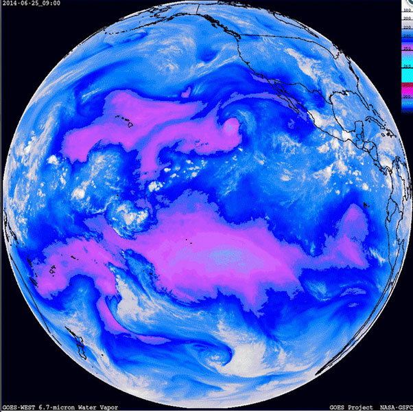 Observations from the National Oceanic and Atmospheric Administration’s Geostationary Operational Environmental Satellites (GOES) measure the local air temperature in kelvins (degrees Kelvin) at different layers of the atmosphere. “The different temperature ranges are color coded in the animations so that the magenta color indicates areas where clear, dry air penetrates lower in the atmosphere,” said Dennis Chesters, the flight project scientist for the NASA/NOAA GOES Program at NASA’s Goddard Space Flight Center in Greenbelt, Maryland. “These animations track mid-level dry-air winds that are otherwise unknown to weather forecasters.” Read more
